
Views in Australia, Egypt, Aden, Asia and other places chiefly circa 1908-1915 (Y3011B(LS))
The collection was originally housed in seven boxes, four of which were specially made with individual slots for slides. These were numbered 3, 6, 10 and 11 and the remaining boxes were unnumbered. Presumably these formed part of a larger collection, but nothing is known of the original owner or the fate of any other boxes. For conservation reasons, the collection has since been re-boxed. The captions given are normally those which appear on the slides themselves.
The photographer of this collection is unknown. He apparently travelled to Australia on the 'Indraghiri' in 1908 and was in the Red Sea on the 'Indraghiri' or the 'Indrawadi' in 1909 (119, 125-6). He apparently visited China in 1909 and 1911 (230 and 221). Slides of the Netherlands East Indies (Indonesia) are dated 1909 (323), 1910 (267-268), and there is a sequence of cultivation on Belang-Belang between 1911 and 1915 (294-301). Several pictures were taken on the 'Highland Glen' and the 'Highland Rover' in 1914 (437-441) and 173, showing the Hong Kong cenotaph, must be post World War I.
The only clue to the photographer is in initials to some of the captions. 'WD' appears in scenes scattered through the series, e.g. 39, 41, 52, 119, 274 and 323 and he could be the photographer or a companion. For at least part of his travels WD was associated with HPA - they appear together in Batjan in 1910 (275-277). HPA is seen in some of the photographs taken in Ceylon (Sri Lanka) 1910-1911 (355-6 and 358). Other photographs taken at this time include PCA and Maude (presumably his wife). He appears to have been manager or owner of Watagoda, an estate in Ceylon. There was an H.P.C. Armitage, Assistant Conservator of Forests in Ceylon who retired in 1903, but it has not been possible to examine any directories of Ceylon in 1910 to see whether PCA might be his brother. Any suggested identification of these individuals must be highly speculative.
Information about this document
- Physical Location: Cambridge University Library: Royal Commonwealth Society Library
- Classmark: Y3011B(LS)
- Author(s): Unknown
- Date of Creation: circa 1908-circa 1915 (Only occasional slides are dated and these suggest that the majority of the photographs were taken between about 1908 and 1915, though there is one of Athens dated 1905 and one which appears to be post World War I.)
- Associated Place(s): Africa (continent); Asia (continent); Australia (nation); Brazil (nation); Celebes Sea (sea); China (nation); Egypt (nation); Europe (continent); Gibraltar (dependent state); Greece (nation); Indian Ocean (ocean); Indonesia (nation); Japan (nation); Malay Archipelago (general region); Malay Peninsula (peninsula); Malaysia (nation); Malta (nation); Oceania (continent); Palestine (historic region); Philippines (nation); Red Sea (sea); South America (continent); Spain (nation); Sri Lanka (nation); Taiwan (nation); United Kingdom (nation); Yemen (nation)
- Extent: 464 images in 29 boxes
- Material: lantern slide
- Author(s) of the Record: RMR
Section shown in images 1 to 87
- Classmark: Y3011B(LS)/1-87
- Title: Australia; Sydney, Newcastle, the Blue Mountains; farms in Victoria and Melbourne
- Abstract:
Also described as: 'The Roaring Forties and Australia 1908'.
- Date of Creation: circa 1908
- Associated Place(s): Athens (inhabited place); Attica (department); Australia (nation); Blue Mountains (mountain range); Central Greece and Euboea (region); Europe (continent); Frankston (inhabited place); Greece (nation); Hyde Park (park); Indian Ocean (ocean); Katoomba (inhabited place); Melbourne (inhabited place); Mornington (inhabited place); Mosman (inhabited place); New South Wales (state); Oceania (continent); Periféreia Protevoúsis (region); Royal National Park (national park); Sydney (inhabited place); Victoria (state); Woolloomooloo Bay (bay)
Section shown in images 35 to 35
- Classmark: Y3011B(LS)/35
- Title: Australia - Sydney - Woolloomalloo [sic] B[ay] [i.e. Woolloomooloo Bay]
- Abstract:
A view from the Botanic Gardens looking towards a sailing ship moored on the far side of Woolloomooloo Bay.
- Associated Place(s): Australia (nation); New South Wales (state); Oceania (continent); Sydney (inhabited place); Woolloomooloo Bay (bay)
Want to know more?
Under the 'More' menu you can find metadata about the item, and information about sharing this image.


- Physical Location: Cambridge University Library: Royal Commonwealth Society Library
- Classmark: Y3011B(LS)
- Author(s): Unknown
- Date of Creation: circa 1908-circa 1915 (Only occasional slides are dated and these suggest that the majority of the photographs were taken between about 1908 and 1915, though there is one of Athens dated 1905 and one which appears to be post World War I.)
- Associated Place(s): Africa (continent); Asia (continent); Australia (nation); Brazil (nation); Celebes Sea (sea); China (nation); Egypt (nation); Europe (continent); Gibraltar (dependent state); Greece (nation); Indian Ocean (ocean); Indonesia (nation); Japan (nation); Malay Archipelago (general region); Malay Peninsula (peninsula); Malaysia (nation); Malta (nation); Oceania (continent); Palestine (historic region); Philippines (nation); Red Sea (sea); South America (continent); Spain (nation); Sri Lanka (nation); Taiwan (nation); United Kingdom (nation); Yemen (nation)
- Extent: 464 images in 29 boxes
- Material: lantern slide
- Author(s) of the Record: RMR
- Classmark: Y3011B(LS)/1-87
- Title: Australia; Sydney, Newcastle, the Blue Mountains; farms in Victoria and Melbourne
- Abstract:
Also described as: 'The Roaring Forties and Australia 1908'.
- Date of Creation: circa 1908
- Associated Place(s): Athens (inhabited place); Attica (department); Australia (nation); Blue Mountains (mountain range); Central Greece and Euboea (region); Europe (continent); Frankston (inhabited place); Greece (nation); Hyde Park (park); Indian Ocean (ocean); Katoomba (inhabited place); Melbourne (inhabited place); Mornington (inhabited place); Mosman (inhabited place); New South Wales (state); Oceania (continent); Periféreia Protevoúsis (region); Royal National Park (national park); Sydney (inhabited place); Victoria (state); Woolloomooloo Bay (bay)
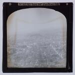
- Classmark: Y3011B(LS)/1
- Title: Athens from Mt Kynthos, 1905
- Abstract:
A panoramic view looking over the city.
- Date of Creation: 1905
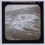
- Classmark: Y3011B(LS)/2
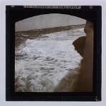
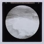
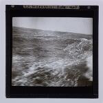
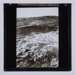
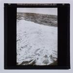
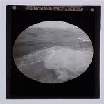
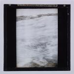
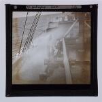
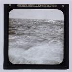
- Title: S.S. 'Indraghiri' in the Roaring Forties, 1908
- Abstract:
One of a series of photographs taken aboard of S.S. 'Indraghiri' during gales encountered while 'running the easting down' - i.e. while on the long and fast haul between the Cape and Australia between latitudes 40° and 50°.
- Date of Creation: 1908
- Associated Place(s): Indian Ocean (ocean)
- Classmark: Y3011B(LS)/3
- Title: S.S. 'Indraghiri' in the Roaring Forties, 1908
- Abstract:
One of a series of photographs taken aboard of S.S. 'Indraghiri' during gales encountered while 'running the easting down' - i.e. while on the long and fast haul between the Cape and Australia between latitudes 40° and 50°.
- Date of Creation: 1908
- Associated Place(s): Indian Ocean (ocean)
- Classmark: Y3011B(LS)/4
- Title: S.S. 'Indraghiri' in the Roaring Forties, 1908
- Abstract:
One of a series of photographs taken aboard of S.S. 'Indraghiri' during gales encountered while 'running the easting down' - i.e. while on the long and fast haul between the Cape and Australia between latitudes 40° and 50°.
- Date of Creation: 1908
- Associated Place(s): Indian Ocean (ocean)
- Classmark: Y3011B(LS)/5
- Title: S.S. 'Indraghiri' in the Roaring Forties, 1908
- Abstract:
One of a series of photographs taken aboard of S.S. 'Indraghiri' during gales encountered while 'running the easting down' - i.e. while on the long and fast haul between the Cape and Australia between latitudes 40° and 50°.
- Date of Creation: 1908
- Associated Place(s): Indian Ocean (ocean)
- Classmark: Y3011B(LS)/6
- Title: S.S. 'Indraghiri' in the Roaring Forties, 1908
- Abstract:
One of a series of photographs taken aboard of S.S. 'Indraghiri' during gales encountered while 'running the easting down' - i.e. while on the long and fast haul between the Cape and Australia between latitudes 40° and 50°.
- Date of Creation: 1908
- Associated Place(s): Indian Ocean (ocean)
- Classmark: Y3011B(LS)/7
- Title: S.S. 'Indraghiri' in the Roaring Forties, 1908
- Abstract:
One of a series of photographs taken aboard of S.S. 'Indraghiri' during gales encountered while 'running the easting down' - i.e. while on the long and fast haul between the Cape and Australia between latitudes 40° and 50°.
- Date of Creation: 1908
- Associated Place(s): Indian Ocean (ocean)
- Classmark: Y3011B(LS)/8
- Title: S.S. 'Indraghiri' in the Roaring Forties, 1908
- Abstract:
One of a series of photographs taken aboard of S.S. 'Indraghiri' during gales encountered while 'running the easting down' - i.e. while on the long and fast haul between the Cape and Australia between latitudes 40° and 50°.
- Date of Creation: 1908
- Associated Place(s): Indian Ocean (ocean)
- Classmark: Y3011B(LS)/9
- Title: S.S. 'Indraghiri' in the Roaring Forties, 1908
- Abstract:
One of a series of photographs taken aboard of S.S. 'Indraghiri' during gales encountered while 'running the easting down' - i.e. while on the long and fast haul between the Cape and Australia between latitudes 40° and 50°.
- Date of Creation: 1908
- Associated Place(s): Indian Ocean (ocean)
- Classmark: Y3011B(LS)/10
- Title: S.S. 'Indraghiri' in the Roaring Forties, 1908
- Abstract:
One of a series of photographs taken aboard of S.S. 'Indraghiri' during gales encountered while 'running the easting down' - i.e. while on the long and fast haul between the Cape and Australia between latitudes 40° and 50°.
- Date of Creation: 1908
- Associated Place(s): Indian Ocean (ocean)
- Classmark: Y3011B(LS)/11
- Title: S.S. 'Indraghiri' in the Roaring Forties, 1908
- Abstract:
One of a series of photographs taken aboard of S.S. 'Indraghiri' during gales encountered while 'running the easting down' - i.e. while on the long and fast haul between the Cape and Australia between latitudes 40° and 50°.
- Date of Creation: 1908
- Associated Place(s): Indian Ocean (ocean)
- Classmark: Y3011B(LS)/12
- Title: S.S. 'Indraghiri' in the Roaring Forties, 1908
- Abstract:
One of a series of photographs taken aboard of S.S. 'Indraghiri' during gales encountered while 'running the easting down' - i.e. while on the long and fast haul between the Cape and Australia between latitudes 40° and 50°.
- Date of Creation: 1908
- Associated Place(s): Indian Ocean (ocean)
- Classmark: Y3011B(LS)/13
- Title: S.S. 'Indraghiri' in the Roaring Forties, 1908
- Abstract:
One of a series of photographs taken aboard of S.S. 'Indraghiri' during gales encountered while 'running the easting down' - i.e. while on the long and fast haul between the Cape and Australia between latitudes 40° and 50°.
- Date of Creation: 1908
- Associated Place(s): Indian Ocean (ocean)
- Classmark: Y3011B(LS)/14
- Title: S.S. 'Indraghiri' in the Roaring Forties, 1908
- Abstract:
One of a series of photographs taken aboard of S.S. 'Indraghiri' during gales encountered while 'running the easting down' - i.e. while on the long and fast haul between the Cape and Australia between latitudes 40° and 50°.
- Date of Creation: 1908
- Associated Place(s): Indian Ocean (ocean)
- Classmark: Y3011B(LS)/15
- Title: S.S. 'Indraghiri' in the Roaring Forties, 1908
- Abstract:
One of a series of photographs taken aboard of S.S. 'Indraghiri' during gales encountered while 'running the easting down' - i.e. while on the long and fast haul between the Cape and Australia between latitudes 40° and 50°.
- Date of Creation: 1908
- Associated Place(s): Indian Ocean (ocean)
- Classmark: Y3011B(LS)/16
- Title: S.S. 'Indraghiri' in the Roaring Forties, 1908
- Abstract:
One of a series of photographs taken aboard of S.S. 'Indraghiri' during gales encountered while 'running the easting down' - i.e. while on the long and fast haul between the Cape and Australia between latitudes 40° and 50°.
- Date of Creation: 1908
- Associated Place(s): Indian Ocean (ocean)
- Classmark: Y3011B(LS)/17
- Title: S.S. 'Indraghiri' in the Roaring Forties, 1908
- Abstract:
One of a series of photographs taken aboard of S.S. 'Indraghiri' during gales encountered while 'running the easting down' - i.e. while on the long and fast haul between the Cape and Australia between latitudes 40° and 50°.
- Date of Creation: 1908
- Associated Place(s): Indian Ocean (ocean)
- Classmark: Y3011B(LS)/18
- Title: S.S. 'Indraghiri' in the Roaring Forties, 1908
- Abstract:
One of a series of photographs taken aboard of S.S. 'Indraghiri' during gales encountered while 'running the easting down' - i.e. while on the long and fast haul between the Cape and Australia between latitudes 40° and 50°.
- Date of Creation: 1908
- Associated Place(s): Indian Ocean (ocean)
- Classmark: Y3011B(LS)/19
- Title: S.S. 'Indraghiri' in the Roaring Forties, 1908
- Abstract:
One of a series of photographs taken aboard of S.S. 'Indraghiri' during gales encountered while 'running the easting down' - i.e. while on the long and fast haul between the Cape and Australia between latitudes 40° and 50°.
- Date of Creation: 1908
- Associated Place(s): Indian Ocean (ocean)
- Classmark: Y3011B(LS)/20
- Title: S.S. 'Indraghiri' in the Roaring Forties, 1908
- Abstract:
One of a series of photographs taken aboard of S.S. 'Indraghiri' during gales encountered while 'running the easting down' - i.e. while on the long and fast haul between the Cape and Australia between latitudes 40° and 50°.
- Date of Creation: 1908
- Associated Place(s): Indian Ocean (ocean)
- Classmark: Y3011B(LS)/21
- Title: S.S. 'Indraghiri' in the Roaring Forties, 1908
- Abstract:
One of a series of photographs taken aboard of S.S. 'Indraghiri' during gales encountered while 'running the easting down' - i.e. while on the long and fast haul between the Cape and Australia between latitudes 40° and 50°.
- Date of Creation: 1908
- Associated Place(s): Indian Ocean (ocean)
- Classmark: Y3011B(LS)/22
- Title: S.S. 'Indraghiri' in the Roaring Forties, 1908
- Abstract:
One of a series of photographs taken aboard of S.S. 'Indraghiri' during gales encountered while 'running the easting down' - i.e. while on the long and fast haul between the Cape and Australia between latitudes 40° and 50°.
- Date of Creation: 1908
- Associated Place(s): Indian Ocean (ocean)
- Classmark: Y3011B(LS)/23
- Title: S.S. 'Indraghiri' in the Roaring Forties, 1908
- Abstract:
One of a series of photographs taken aboard of S.S. 'Indraghiri' during gales encountered while 'running the easting down' - i.e. while on the long and fast haul between the Cape and Australia between latitudes 40° and 50°.
- Date of Creation: 1908
- Associated Place(s): Indian Ocean (ocean)
- Classmark: Y3011B(LS)/24
- Title: S.S. 'Indraghiri' in the Roaring Forties, 1908
- Abstract:
One of a series of photographs taken aboard of S.S. 'Indraghiri' during gales encountered while 'running the easting down' - i.e. while on the long and fast haul between the Cape and Australia between latitudes 40° and 50°.
- Date of Creation: 1908
- Associated Place(s): Indian Ocean (ocean)
- Classmark: Y3011B(LS)/25
- Title: S.S. 'Indraghiri' in the Roaring Forties, 1908
- Abstract:
One of a series of photographs taken aboard of S.S. 'Indraghiri' during gales encountered while 'running the easting down' - i.e. while on the long and fast haul between the Cape and Australia between latitudes 40° and 50°.
- Date of Creation: 1908
- Associated Place(s): Indian Ocean (ocean)
- Classmark: Y3011B(LS)/26
- Title: S.S. 'Indraghiri' in the Roaring Forties, 1908
- Abstract:
One of a series of photographs taken aboard of S.S. 'Indraghiri' during gales encountered while 'running the easting down' - i.e. while on the long and fast haul between the Cape and Australia between latitudes 40° and 50°.
- Date of Creation: 1908
- Associated Place(s): Indian Ocean (ocean)
- Classmark: Y3011B(LS)/27
- Title: S.S. 'Indraghiri' in the Roaring Forties, 1908
- Abstract:
One of a series of photographs taken aboard of S.S. 'Indraghiri' during gales encountered while 'running the easting down' - i.e. while on the long and fast haul between the Cape and Australia between latitudes 40° and 50°.
- Date of Creation: 1908
- Associated Place(s): Indian Ocean (ocean)
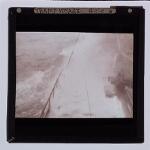
- Classmark: Y3011B(LS)/28
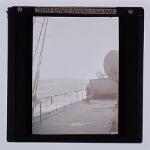
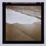
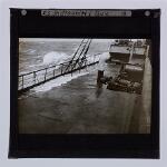
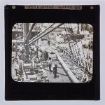
- Title: Tramp Voyage - Sydney
- Abstract:
A clear photograph showing work in progress on the deck of S.S. 'Indraghiri', with harbour waves at the right of the slide.
- Associated Place(s): Australia (nation); New South Wales (state); Oceania (continent); Sydney (inhabited place)
- Classmark: Y3011B(LS)/29
- Title: Australia - Sydney - My ship
- Abstract:
A view from the wharf showing the S.S. Indraghiri at her moorings, with a horse and cart in the foreground.
- Associated Place(s): Australia (nation); New South Wales (state); Oceania (continent); Sydney (inhabited place)
- Classmark: Y3011B(LS)/30
- Title: Australia - Sydney, My ship
- Abstract:
A more distant view of the 'Indraghiri' from the wharf.
- Associated Place(s): Australia (nation); New South Wales (state); Oceania (continent); Sydney (inhabited place)
- Classmark: Y3011B(LS)/31
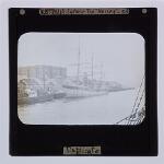
- Title: Australia - Sydney - Our wharf
- Abstract:
A view from the ship showing part of the Circular Quay, with Tiser's Wharf at the right.
- Associated Place(s): Australia (nation); New South Wales (state); Oceania (continent); Sydney (inhabited place)
- Classmark: Y3011B(LS)/32
- Title: Australia - Sydney Harbour
- Abstract:
A view looking across wharf facilities with the 'only Australian built steamer' (pencilled on mount) at her moorings.
- Associated Place(s): Australia (nation); New South Wales (state); Oceania (continent); Sydney (inhabited place)
- Classmark: Y3011B(LS)/33
- Title: Australia - Sydney - The 'Mersey'
- Abstract:
A view showing the 'Mersey', a three-masted sailing vessel, moored to a wharf in Sydney Harbour.
- Associated Place(s): Australia (nation); New South Wales (state); Oceania (continent); Sydney (inhabited place)
- Classmark: Y3011B(LS)/34
- Title: Australia - Sydney - Woolloomalloo [sic] B[ay] [i.e. Woolloomooloo Bay]
- Abstract:
A view looking east from the Botanic Gardens towards a ship anchored in Woolloomooloo Bay.
- Associated Place(s): Australia (nation); New South Wales (state); Oceania (continent); Sydney (inhabited place); Woolloomooloo Bay (bay)
- Classmark: Y3011B(LS)/35
- Title: Australia - Sydney - Woolloomalloo [sic] B[ay] [i.e. Woolloomooloo Bay]
- Abstract:
A view from the Botanic Gardens looking towards a sailing ship moored on the far side of Woolloomooloo Bay.
- Associated Place(s): Australia (nation); New South Wales (state); Oceania (continent); Sydney (inhabited place); Woolloomooloo Bay (bay)
- Classmark: Y3011B(LS)/36
- Title: Australia - Sydney - Woolloomalloo [sic] B[ay] [i.e. Woolloomooloo Bay]
- Abstract:
A view looking across Woolloomooloo Bay towards wharves on the far side.
- Associated Place(s): Australia (nation); New South Wales (state); Oceania (continent); Sydney (inhabited place); Woolloomooloo Bay (bay)
- Classmark: Y3011B(LS)/37
- Title: Australia - Sydney Harbour
- Abstract:
A view looking along the northern shore of the harbour with a small lighthouse in the foreground.
- Associated Place(s): Australia (nation); New South Wales (state); Oceania (continent); Sydney (inhabited place)
- Classmark: Y3011B(LS)/38
- Title: Australia - Sydney Harbour
- Abstract:
A view showing the small island of Fort Denison in Sydney Harbour.
- Associated Place(s): Australia (nation); New South Wales (state); Oceania (continent); Sydney (inhabited place)
- Classmark: Y3011B(LS)/39
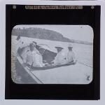
- Title: Australia - Sydney Harbour
- Abstract:
A view showing four naval officers in a launch in Sydney Harbour, with W.D. at the right (see originator details in the Fonds Level entry for this collection).
- Associated Place(s): Australia (nation); New South Wales (state); Oceania (continent); Sydney (inhabited place)
- Classmark: Y3011B(LS)/40
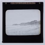
- Title: Australia - Sydney - Manley Beach
- Abstract:
A view looking along the sandy beach with a headland in the distance.
- Associated Place(s): Australia (nation); New South Wales (state); Oceania (continent); Sydney (inhabited place)
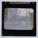
- Classmark: Y3011B(LS)/41
- Title: Australia - Sydney
- Abstract:
A view showing three men in a pony-trap on a Sydney wharf with W.D. (see originator details in the Fonds Level entry for this collection) sitting in the centre.
- Associated Place(s): Australia (nation); New South Wales (state); Oceania (continent); Sydney (inhabited place)
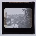
- Classmark: Y3011B(LS)/42
- Title: Australia - Sydney - Mossmans [i.e. Mosman]
- Abstract:
A view looking down onto a bay from a hillside, with houses on the slope.
- Associated Place(s): Australia (nation); Mosman (inhabited place); New South Wales (state); Oceania (continent); Sydney (inhabited place)
- Classmark: Y3011B(LS)/43
- Title: Australia - Sydney
- Abstract:
A view showing St Mary's Roman Catholic Cathedral, with the Frazer Fountain partially visible at the left.
- Associated Place(s): Australia (nation); New South Wales (state); Oceania (continent); Sydney (inhabited place)
- Classmark: Y3011B(LS)/44
- Title: Australia - Sydney - Statue
- Abstract:
A view showing the statue of Captain Cook in Hyde Park, erected in 1879.
- Associated Place(s): Australia (nation); Hyde Park (park); New South Wales (state); Oceania (continent); Sydney (inhabited place)
- Classmark: Y3011B(LS)/45
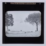
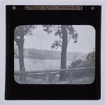
- Title: Australia - Sydney - National Park [i.e. Royal National Park]
- Abstract:
A view looking down on the Port Hacking River with wooded hills on both banks.
- Classmark: Y3011B(LS)/46
- Title: Australia - Sydney - National Park [i.e. Royal National Park]
- Abstract:
A view showing a boat and a punt ferry moored to wooden jetties, probably at the National Park Camp at Audley.
- Classmark: Y3011B(LS)/47
- Title: Australia - Sydney - National Park [i.e. Royal National Park]
- Abstract:
A scene on the Port Hacking River with trees in the foreground and on the farther bank.
- Classmark: Y3011B(LS)/48
- Title: Australia - Sydney - National Park [i.e. Royal National Park]
- Abstract:
A view looking towards a wooden bridge over the river, probably near Port Hacking.
- Classmark: Y3011B(LS)/49
- Title: Australia - Sydney - National Park [i.e. Royal National Park]
- Abstract:
A view showing a horse drawn coach in the park.
- Classmark: Y3011B(LS)/50
- Title: Australia - Sydney - National Park [i.e. Royal National Park]
- Abstract:
A view looking across the Port Hacking River towards a long barn on the far bank.
- Classmark: Y3011B(LS)/51
- Title: Australia - Sydney - National Park [i.e. Royal National Park]
- Abstract:
A view showing an unidentified party of five men and women strolling in the park.
- Classmark: Y3011B(LS)/52
- Title: Australia - Sydney - National Park [i.e. Royal National Park]
- Abstract:
A view showing four men on a road in the park, with W.D. second from the right.
- Classmark: Y3011B(LS)/53
- Title: Australia - Sydney - National Park [i.e. Royal National Park]
- Abstract:
A view showing four men standing on a wooden jetty with WD on the right.
- Classmark: Y3011B(LS)/54
- Title: Wreck - Newcastle, NSW [i.e. New South Wales]
- Abstract:
A view showing the hull of an unidentified ship beached on the Newcastle breakwater.
- Associated Place(s): Australia (nation); New South Wales (state); Newcastle (inhabited place); Oceania (continent)
- Classmark: Y3011B(LS)/55
- Title: Wreck - French ship - Newcastle
- Abstract:
A view showing the hull of an unidentified ship beached on the Newcastle breakwater, with Newcastle harbour in the background and the city in the distance.
- Associated Place(s): Australia (nation); New South Wales (state); Newcastle (inhabited place); Oceania (continent)
- Classmark: Y3011B(LS)/56
- Title: Wreck - Newcastle, Australia
- Abstract:
A view showing the deck of a French ship.
- Associated Place(s): Australia (nation); New South Wales (state); Newcastle (inhabited place); Oceania (continent)
- Classmark: Y3011B(LS)/57
- Title: Wreck - French - Newcastle, NSW [i.e. New South Wales]
- Abstract:
A view of the deck of a French wreck.
- Associated Place(s): Australia (nation); New South Wales (state); Newcastle (inhabited place); Oceania (continent)
- Classmark: Y3011B(LS)/58
- Title: Australia - Newcastle Breakwater
- Abstract:
A view showing the landward section of the (?) Northern breakwater at Newcastle.
- Associated Place(s): Australia (nation); New South Wales (state); Newcastle (inhabited place); Oceania (continent)
- Classmark: Y3011B(LS)/59
- Title: Newcastle, NSW [i.e. New South Wales] - Breakwater
- Abstract:
A view showing part of the (?) southern breakwater at Newcastle.
- Associated Place(s): Australia (nation); New South Wales (state); Newcastle (inhabited place); Oceania (continent)
- Classmark: Y3011B(LS)/60
- Title: Australia - Newcastle Docks - 1909
- Abstract:
A view looking along the wharves towards Nobby's Head in the distance.
- Date of Creation: 1909
- Associated Place(s): Australia (nation); New South Wales (state); Newcastle (inhabited place); Oceania (continent)
- Classmark: Y3011B(LS)/61
- Title: Australia - Newcastle
- Abstract:
A view looking along a street in Newcastle towards the docks, with an unidentified tower (? The railway station) on the right hand side.
- Associated Place(s): Australia (nation); New South Wales (state); Newcastle (inhabited place); Oceania (continent)
- Classmark: Y3011B(LS)/62
- Title: Australia - Newcastle, NSW [i.e. New South Wales]
- Abstract:
A view looking along an unidentified tree-lined street in Newcastle.
- Associated Place(s): Australia (nation); New South Wales (state); Newcastle (inhabited place); Oceania (continent)
- Classmark: Y3011B(LS)/63
- Title: Australia - Newcastle, NSW [i.e. New South Wales]
- Abstract:
A view looking along an unidentified street in Newcastle with tramlines, and pony-traps parked on the far side.
- Associated Place(s): Australia (nation); New South Wales (state); Newcastle (inhabited place); Oceania (continent)
- Classmark: Y3011B(LS)/64
- Title: Australia - Blue Mts [i.e. Blue Mountains] - Half-Caste
- Abstract:
A view showing a man of mixed-race standing in a clearing with bush beyond.
- Associated Place(s): Australia (nation); Blue Mountains (mountain range); New South Wales (state); Oceania (continent)
- Classmark: Y3011B(LS)/65
- Title: Australia - Blue Mts[i.e. Blue Mountains] - Cording wood
- Abstract:
A view showing felled timber stacked in piles ready for transportation.
- Associated Place(s): Australia (nation); Blue Mountains (mountain range); New South Wales (state); Oceania (continent)
- Classmark: Y3011B(LS)/66
- Title: Australia - Blue Mts [i.e. Blue Mountains] - Cricket Pitch
- Abstract:
A view showing a makeshift cricket pitch in the bush.
- Associated Place(s): Australia (nation); Blue Mountains (mountain range); New South Wales (state); Oceania (continent)
- Classmark: Y3011B(LS)/67
- Title: Australia - Blue Mts [i.e. Blue Mountains] - Waterfall, Mid-Sumr
- Abstract:
A view showing the thin trickle of water dropping over the Wentworth Falls.
- Associated Place(s): Australia (nation); Blue Mountains (mountain range); New South Wales (state); Oceania (continent)
- Classmark: Y3011B(LS)/68
- Title: Australia - Blue Mts [i.e. Blue Mountains] - Waterfall, midsummer
- Abstract:
A view looking over the Wentworth Falls.
- Associated Place(s): Australia (nation); Blue Mountains (mountain range); New South Wales (state); Oceania (continent)
- Classmark: Y3011B(LS)/69
- Title: Australia - Blue Mts [i.e. Blue Mountains]
- Abstract:
A view showing the Three Sisters, the outcrops of rock which stand over the Jamieson Valley.
- Associated Place(s): Australia (nation); Blue Mountains (mountain range); New South Wales (state); Oceania (continent)
- Classmark: Y3011B(LS)/70
- Title: Australia - Blue Mts [i.e. Blue Mountains]
- Abstract:
A view showing woods beside a path in the Blue Mountains.
- Associated Place(s): Australia (nation); Blue Mountains (mountain range); New South Wales (state); Oceania (continent)
- Classmark: Y3011B(LS)/71
- Title: Australia - Blue Mts [i.e. Blue Mountains] - The Narrows
- Abstract:
A view looking along the Narrow Neck Peninsula which lies south of Katoomba.
- Associated Place(s): Australia (nation); Blue Mountains (mountain range); New South Wales (state); Oceania (continent)
- Classmark: Y3011B(LS)/72
- Title: Australia - Blue Mts [i.e. Blue Mountains] - Katoomba
- Abstract:
A view showing mountainous scenery near Katoomba.
- Classmark: Y3011B(LS)/73
- Title: Australia - Blue Mts [i.e. Blue Mountains] - Mt Solitary
- Abstract:
A view looking towards the flat-topped Mt Solitary from the Narrow Neck Peninsula.
- Associated Place(s): Australia (nation); Blue Mountains (mountain range); New South Wales (state); Oceania (continent)
- Classmark: Y3011B(LS)/74
- Title: Australia - Blue Mts [i.e. Blue Mountains] - Katoomba
- Abstract:
A view showing an unidentified house and garden in Katoomba.
- Classmark: Y3011B(LS)/75
- Title: Australia - Blue Mts [i.e. Blue Mountains]
- Abstract:
A view showing an unidentified house and garden in Katoomba.
- Classmark: Y3011B(LS)/76
- Title: Australia - Blue Mts [i.e. Blue Mountains] - Bush
- Abstract:
A view showing a settler's cabin in the bush.
- Associated Place(s): Australia (nation); Blue Mountains (mountain range); New South Wales (state); Oceania (continent)
- Classmark: Y3011B(LS)/77
- Title: Australia - Blue Mts [i.e. Blue Mountains] - Bush
- Abstract:
A view showing partially cleared land, with a pony trap in the background.
- Associated Place(s): Australia (nation); Blue Mountains (mountain range); New South Wales (state); Oceania (continent)
- Classmark: Y3011B(LS)/78
- Title: Australia - Bush - Blue Mts [i.e. Blue Mountains]
- Abstract:
A view showing partially cleared and fenced-off land.
- Associated Place(s): Australia (nation); Blue Mountains (mountain range); New South Wales (state); Oceania (continent)
- Classmark: Y3011B(LS)/79
- Title: Australia - Blue Mts [i.e. Blue Mountains]: Bush
- Abstract:
A view showing a settler's small cabin with a bark roof.
- Associated Place(s): Australia (nation); Blue Mountains (mountain range); New South Wales (state); Oceania (continent)
- Classmark: Y3011B(LS)/80
- Title: Australia - Blue Mts [i.e. Blue Mountains] - Bush
- Abstract:
A view showing sheep grazing in partially cleared woodland.
- Associated Place(s): Australia (nation); Blue Mountains (mountain range); New South Wales (state); Oceania (continent)
- Classmark: Y3011B(LS)/81
- Title: Australia - Fruit Farm - Frankston [Victoria]
- Abstract:
A view showing two men standing in front of a brick house.
- Associated Place(s): Australia (nation); Frankston (inhabited place); Oceania (continent); Victoria (state)
- Classmark: Y3011B(LS)/82
- Title: Australia - Frankston - Nr Melbourne
- Abstract:
A view showing the tiny railway station at Mornington Junction, with merchandise and a few travellers on the platform and small wooden station buildings in the background.
- Associated Place(s): Australia (nation); Frankston (inhabited place); Mornington (inhabited place); Oceania (continent); Victoria (state)
- Classmark: Y3011B(LS)/83
- Title: Australia - Nr Melbourne - Fruit farm
- Abstract:
A view looking towards a small wooden house with fields beyond.
- Associated Place(s): Australia (nation); Melbourne (inhabited place); Oceania (continent); Victoria (state)
- Classmark: Y3011B(LS)/84
- Title: Australia - Nr Melbourne, Fruit farm
- Abstract:
A view showing two men (W.D. at left) standing in front of farm buildings.
- Associated Place(s): Australia (nation); Melbourne (inhabited place); Oceania (continent); Victoria (state)
- Classmark: Y3011B(LS)/85
- Title: Australia - Nr Melbourne - Fruit farm
- Abstract:
A view showing two men (W.D. at left) and a dog posed in front of a fruit tree.
- Associated Place(s): Australia (nation); Melbourne (inhabited place); Oceania (continent); Victoria (state)
- Classmark: Y3011B(LS)/86
- Title: Australia - Nr Melbourne - Fruit farm
- Associated Place(s): Australia (nation); Melbourne (inhabited place); Oceania (continent); Victoria (state)
- Classmark: Y3011B(LS)/87
- Title: Melbourne - SS 'Geelong'
- Abstract:
A view showing the 'Geelong' being towed by a tug in Melbourne Harbour.
- Associated Place(s): Australia (nation); Melbourne (inhabited place); Oceania (continent); Victoria (state)
- Classmark: Y3011B(LS)/88-133
- Title: Port Said, Suez, and Aden [i.e. Adan] 1909
- Date of Creation: 1909
- Associated Place(s): Adan (governate); Adan (inhabited place); Africa (continent); Al-Isma`iliyah (governate); Al-Isma`iliyah (inhabited place); Asia (continent); Barim (island); Bur Tawfiq (neighbourhood); Desert (region); Egypt (nation); Janub Sina' (governate); Lower Egypt (region); Mandeb, Bab el (strait); Murrah al Kubrá, Al Buhayrah al (salt lake); Murrah as Sughrá, Al Buhayrah al (salt lake); Musa, Gebel (mountain); Port Said (governorate); Port Said (inhabited place); Red Sea (sea); South Yemen (region); Suez (governorate); Suez (inhabited place); Suways, Qanat as- (canal); Urban (region); Yemen (nation)
- Classmark: Y3011B(LS)/88
- Title: At Port Said - German liner
- Abstract:
A side view showing the central section of an unidentified liner.
- Associated Place(s): Africa (continent); Egypt (nation); Port Said (governorate); Port Said (inhabited place); Urban (region)
- Classmark: Y3011B(LS)/89
- Title: Port Said; Bibby liner
- Abstract:
A view showing an unidentified Bibby Line steamer at anchor in Port Said Harbour.
- Associated Place(s): Africa (continent); Egypt (nation); Port Said (governorate); Port Said (inhabited place); Urban (region)
- Classmark: Y3011B(LS)/90
- Title: Port Said; P and O 'Isis'
- Abstract:
A view showing the 'Isis' at anchor in Port Said Harbour.
- Associated Place(s): Africa (continent); Egypt (nation); Port Said (governorate); Port Said (inhabited place); Urban (region)
- Classmark: Y3011B(LS)/91
- Title: Port Said - 'Clan Ranald'
- Abstract:
A rear-view of the steamer 'Clan Ranald' at anchor in Port Said Harbour.
- Associated Place(s): Africa (continent); Egypt (nation); Port Said (governorate); Port Said (inhabited place); Urban (region)
- Classmark: Y3011B(LS)/92
- Title: Port Said 'Clan Ranald'
- Associated Place(s): Africa (continent); Egypt (nation); Port Said (governorate); Port Said (inhabited place); Urban (region)
- Classmark: Y3011B(LS)/93
- Title: Port Said
- Abstract:
A view showing a dhow in Port Said Harbour.
- Associated Place(s): Africa (continent); Egypt (nation); Port Said (governorate); Port Said (inhabited place); Urban (region)
- Classmark: Y3011B(LS)/94
- Title: Port Said; coaling
- Abstract:
A view showing the steamer 'Imperato' taking on coal from a barge moored to her starboard side.
- Associated Place(s): Africa (continent); Egypt (nation); Port Said (governorate); Port Said (inhabited place); Urban (region)
- Classmark: Y3011B(LS)/95
- Title: Mooring, Port Said
- Abstract:
A view showing a ship's boat taking a line across to the shore.
- Associated Place(s): Africa (continent); Egypt (nation); Port Said (governorate); Port Said (inhabited place); Urban (region)
- Classmark: Y3011B(LS)/96
- Title: Port Said
- Abstract:
A general view of the town from the harbour. The prominent domed building on the waterfront is the Suez Canal Office.
- Associated Place(s): Africa (continent); Egypt (nation); Port Said (governorate); Port Said (inhabited place); Urban (region)
- Classmark: Y3011B(LS)/97
- Title: Port Said
- Abstract:
A view looking across the harbour towards the town, with dhows moored to one of the long harbour breakwaters.
- Associated Place(s): Africa (continent); Egypt (nation); Port Said (governorate); Port Said (inhabited place); Urban (region)
- Classmark: Y3011B(LS)/98
- Title: Port Said
- Abstract:
A view from the harbour looking towards the waterfront.
- Associated Place(s): Africa (continent); Egypt (nation); Port Said (governorate); Port Said (inhabited place); Urban (region)
- Classmark: Y3011B(LS)/99
- Title: Port Said
- Abstract:
A view from the harbour looking towards the waterfront.
- Associated Place(s): Africa (continent); Egypt (nation); Port Said (governorate); Port Said (inhabited place); Urban (region)
- Classmark: Y3011B(LS)/100
- Title: Port Said; de Lesseps statue
- Abstract:
A view looking towards the breakwater on which stands the statue of the builder of the Qanat as-Suways.
- Associated Name(s): Lesseps, Ferdinand de, 1805-1894
- Associated Place(s): Africa (continent); Egypt (nation); Port Said (governorate); Port Said (inhabited place); Suways, Qanat as- (canal); Urban (region)
- Classmark: Y3011B(LS)/101
- Title: Port Said
- Abstract:
A view showing a street in Port Said.
- Associated Place(s): Africa (continent); Egypt (nation); Port Said (governorate); Port Said (inhabited place); Urban (region)
- Classmark: Y3011B(LS)/102
- Title: Port Said
- Abstract:
A view showing a street in Port Said.
- Associated Place(s): Africa (continent); Egypt (nation); Port Said (governorate); Port Said (inhabited place); Urban (region)
- Classmark: Y3011B(LS)/103
- Title: Port Said
- Abstract:
A view showing an Arab driving a pony-cab in the streets of Port Said.
- Associated Place(s): Africa (continent); Egypt (nation); Port Said (governorate); Port Said (inhabited place); Urban (region)
- Classmark: Y3011B(LS)/104
- Title: Suez Canal [i.e. Qanat as-Suways] 'Hitachi Maru'
- Abstract:
A head-on view of the Japanese steamer in the canal.
- Classmark: Y3011B(LS)/105
- Title: Suez Canal [i.e. Qanat as-Suways] - S.Y. 'Lysistrata'
- Abstract:
A head-on view of the steam yacht 'Lysistrata' in the canal.
- Classmark: Y3011B(LS)/106
- Title: Suez Canal [i.e. Qanat as-Suways] - 'Tying up'
- Abstract:
A blurred slide showing two men in a rowing boat taking the mooring line to the shore.
- Classmark: Y3011B(LS)/107
- Title: Suez Canal [i.e. Qanat as-Suways]; 'tying up'
- Abstract:
A view showing the rowing boat near the banks of the canal with the mooring rope trailing behind her back to the ship.
- Classmark: Y3011B(LS)/108
- Title: Suez Canal [i.e. Qanat as-Suways]
- Abstract:
A view showing a small settlement of wooden huts on the bank of the canal.
- Classmark: Y3011B(LS)/109
- Title: Suez Canal [i.e. Qanat as-Suways]; sand storm
- Abstract:
An uninformative slide taken from the ship and showing an undifferentiated blur on the bank of the canal.
- Classmark: Y3011B(LS)/110
- Title: Suez Canal [i.e. Qanat as-Suways]; Bitter Lakes [i.e. Al Buhayrah al Murrah al Kubrá and Al Buhayrah al Murrah as Sughrá (salt lakes)]
- Abstract:
A dull view looking over the Al Buhayrah al Murrah al Kubrá and Al Buhayrah al Murrah as Sughrá (salt lakes).
- Classmark: Y3011B(LS)/111
- Title: Suez Canal [i.e. Qanat as-Suways]. Port Tewfik [i.e. Bur Tawfiq]
- Abstract:
A view showing administrative buildings and a jetty on the canal bank.
- Associated Place(s): Africa (continent); Bur Tawfiq (neighbourhood); Egypt (nation); Suez (governorate); Suways, Qanat as- (canal); Urban (region)
- Classmark: Y3011B(LS)/112
- Title: Suez Canal [i.e. Qanat as-Suways]
- Abstract:
A view showing a palm surrounded house on the bank of the canal with a small wooden jetty in the foreground.
- Classmark: Y3011B(LS)/113
- Title: Suez Canal [i.e. Qanat as-Suways]; Ismailia [i.e. Al-Isma`iliyah]
- Abstract:
A view from the canal showing stone buildings and elevated water tanks of Al-Isma`iliyah.
- Classmark: Y3011B(LS)/114
- Title: Suez
- Abstract:
A view looking shorewards, from the harbour at Suez.
- Associated Place(s): Africa (continent); Egypt (nation); Suez (governorate); Suez (inhabited place); Urban (region)
- Classmark: Y3011B(LS)/115
- Title: Suez - German liner
- Abstract:
A view showing a German liner in the Red Sea near Suez
- Associated Place(s): Africa (continent); Egypt (nation); Red Sea (sea); Suez (governorate); Suez (inhabited place); Urban (region)
- Classmark: Y3011B(LS)/116
- Title: Suez Canal [i.e. Qanat as-Suways]; and Cairo express train
- Abstract:
A view from the Canal showing the Cairo express on the bank.
- Classmark: Y3011B(LS)/117
- Title: Suez Canal [i.e. Qanat as-Suways]; Caravan
- Abstract:
A view from the canal showing a camel caravan on the bank, with one of the lakes on the canal route in the background.
- Classmark: Y3011B(LS)/118
- Title: Suez Canal [i.e. Qanat as-Suways]; caravan
- Abstract:
A view from the canal showing a camel caravan on the bank, with one of the lakes on the canal route in the background.
- Classmark: Y3011B(LS)/119
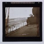
- Title: 'Indraghiri'; Red Sea, Mt Sinai [i.e. Gebel Musa]
- Abstract:
A view showing W.D. on the deck of the 'Indraghiri' looking through a telescope towards Gebel Musa (not visible).
- Associated Place(s): Africa (continent); Desert (region); Egypt (nation); Janub Sina' (governate); Musa, Gebel (mountain); Red Sea (sea)
- Classmark: Y3011B(LS)/120
- Title: Red Sea
- Abstract:
An uninteresting slide showing an unidentified section of coastline.
- Associated Place(s): Red Sea (sea)
- Classmark: Y3011B(LS)/121
- Title: Red Sea - Abu Ail
- Abstract:
A view looking towards two small islands. Exact location unidentified.
- Associated Place(s): Red Sea (sea)
- Classmark: Y3011B(LS)/122
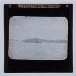
- Title: Perim [i.e. Barim]
- Abstract:
A distant view of the island of Barim situated 100 miles west of `Adan in the centre of the Strait of Bab el Mandeb.
- Associated Place(s): Asia (continent); Barim (island); Mandeb, Bab el (strait); South Yemen (region); Yemen (nation)
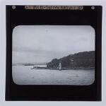
- Classmark: Y3011B(LS)/123
- Title: 'Indrawadi', off Aden [i.e. Adan]
- Abstract:
A view showing the 'Indrawadi' at anchor with the hills of Adan in the distance.
- Classmark: Y3011B(LS)/124
- Title: Aden [i.e. Adan]
- Abstract:
A view showing three men aboard a small motor launch with the 'Indrawadi' at anchor in the background.
- Associated Place(s): Adan (governate); Adan (inhabited place); Asia (continent); South Yemen (region); Yemen (nation)
- Classmark: Y3011B(LS)/125
- Title: Aden [i.e. Adan], SS Indrawadi
- Abstract:
A view showing native boys and a policeman on the deck of the 'Indrawadi'.
- Associated Place(s): Adan (governate); Adan (inhabited place); Asia (continent); South Yemen (region); Yemen (nation)
- Classmark: Y3011B(LS)/126
- Title: ?Aden [i.e. Adan]
- Abstract:
A view showing native workmen unloading merchandise from the deck of the 'Indrawadi', probably at Adan.
- Associated Place(s): Adan (governate); Adan (inhabited place); Asia (continent); South Yemen (region); Yemen (nation)
- Classmark: Y3011B(LS)/127
- Title: Aden [i.e. Adan] - SS Indrawadi 1909
- Abstract:
A view showing the deck of SS Indrawadi with native workmen at the mouth of the hold.
- Date of Creation: 1909
- Associated Place(s): Adan (governate); Adan (inhabited place); Asia (continent); South Yemen (region); Yemen (nation)
- Classmark: Y3011B(LS)/128
- Title: Aden [i.e.Adan]; P and O 'Salsette'
- Abstract:
A view showing the steamer 'Salsette' at anchor off Adan.
- Associated Place(s): Adan (governate); Adan (inhabited place); Asia (continent); South Yemen (region); Yemen (nation)
- Classmark: Y3011B(LS)/129
- Title: Aden [i.e. Adan]; P and O 'Salsette'
- Abstract:
A view showing a rowing boat pulling away from the side of the steamer.
- Associated Place(s): Adan (governate); Adan (inhabited place); Asia (continent); South Yemen (region); Yemen (nation)
- Classmark: Y3011B(LS)/130
- Title: Aden [i.e. Adan] - SS 'Welsh Prince'
- Abstract:
A view showing the steamer 'Welsh Prince' at anchor with the mountains of Adan in the background.
- Associated Place(s): Adan (governate); Adan (inhabited place); Asia (continent); South Yemen (region); Yemen (nation)
- Classmark: Y3011B(LS)/131
- Title: P and O liner, Aden [i.e. Adan]
- Abstract:
A view showing a large steamer moving towards her anchorage with the mountains of Adan in the background.
- Associated Place(s): Adan (governate); Adan (inhabited place); Asia (continent); South Yemen (region); Yemen (nation)
- Classmark: Y3011B(LS)/132
- Title: Aden [i.e. Adan]. Italian warship
- Abstract:
A view showing an Italian warship at anchor in Tawahi Harbour with the town at Steamer Point in the background.
- Associated Place(s): Adan (governate); Adan (inhabited place); Asia (continent); South Yemen (region); Yemen (nation)
- Classmark: Y3011B(LS)/133
- Title: Aden [i.e. Adan]; foreign warships
- Abstract:
A view showing warships at anchor off (?) Crater.
- Associated Place(s): Adan (governate); Adan (inhabited place); Asia (continent); South Yemen (region); Yemen (nation)
- Classmark: Y3011B(LS)/134-182
- Title: Aden [i.e. Adan], Malaya [i.e. Malay Peninsula], and Hong Kong, circa 1909
- Abstract:
Also described as: 'Aden, Hong Kong, ?1909'.
- Date of Creation: circa 1909
- Associated Place(s): Adan (governate); Adan (inhabited place); Asia (continent); China (nation); George Town (inhabited place); Hong Kong (administrative region); Hong Kong (island); Hong Kong Island (area); Johor (state); Johor Baharu (inhabited place); Kowloon (inhabited place); Kowloon and New Kowloon (area); Malay Peninsula (peninsula); Malaysia (nation); Ngong Shuen Chau (island); Pinang (island); Pinang (state); South Yemen (region); Victoria (inhabited place); Victoria Peak (mountain); West Malaysia (division (national)); Yemen (nation)
- Classmark: Y3011B(LS)/134
- Title: Aden [i.e. Adan]
- Abstract:
A view showing several small ships in the harbour at `Adan.
- Associated Place(s): Adan (governate); Adan (inhabited place); Asia (continent); South Yemen (region); Yemen (nation)
- Classmark: Y3011B(LS)/135
- Title: Aden [i.e. Adan]
- Abstract:
A view showing a steamer at anchor in Tawahi Harbour with the town of Steamer Point in the background.
- Associated Place(s): Adan (governate); Adan (inhabited place); Asia (continent); South Yemen (region); Yemen (nation)
- Classmark: Y3011B(LS)/136
- Title: Aden [i.e. Adan]
- Abstract:
A view looking down on a motor launch about to tie up beside the ship.
- Associated Place(s): Adan (governate); Adan (inhabited place); Asia (continent); South Yemen (region); Yemen (nation)
- Classmark: Y3011B(LS)/137
- Title: Aden [i.e. Adan]
- Abstract:
A view showing a party of Indians rowing an officer in white uniform ashore.
- Associated Place(s): Adan (governate); Adan (inhabited place); Asia (continent); South Yemen (region); Yemen (nation)
- Classmark: Y3011B(LS)/138
- Title: Aden [i.e. Adan]
- Abstract:
A view showing a motor launch.
- Associated Place(s): Adan (governate); Adan (inhabited place); Asia (continent); South Yemen (region); Yemen (nation)
- Classmark: Y3011B(LS)/139
- Title: Aden [i.e. Adan], Port
- Abstract:
A view showing the back streets and houses at Steamer Point.
- Associated Place(s): Adan (governate); Adan (inhabited place); Asia (continent); South Yemen (region); Yemen (nation)
- Classmark: Y3011B(LS)/140
- Title: Aden [i.e. Adan]; Port
- Abstract:
A view looking along Prince of Wales Crescent at Steamer Point with the Hotel de l'Europe at the left.
- Associated Place(s): Adan (governate); Adan (inhabited place); Asia (continent); South Yemen (region); Yemen (nation)
- Classmark: Y3011B(LS)/141
- Title: Aden [i.e. Adan], Port
- Abstract:
A view looking along Prince of Wales Crescent, Steamer Point,.
- Associated Place(s): Adan (governate); Adan (inhabited place); Asia (continent); South Yemen (region); Yemen (nation)
- Classmark: Y3011B(LS)/142
- Title: Aden [i.e. Adan]
- Abstract:
A view from the harbour looking towards Steamer Point with dhows and steam vessels at anchor in the foreground.
- Associated Place(s): Adan (governate); Adan (inhabited place); Asia (continent); South Yemen (region); Yemen (nation)
- Classmark: Y3011B(LS)/143
- Title: Aden [i.e. Adan]; Port
- Abstract:
A view looking down on the Crater - Steamer Point Road with the town and Tawahi Harbour beyond.
- Associated Place(s): Adan (governate); Adan (inhabited place); Asia (continent); South Yemen (region); Yemen (nation)
- Classmark: Y3011B(LS)/144
- Title: Aden [i.e. Adan]
- Abstract:
A view looking along an unidentified street with rocky hillside beyond, probably at Steamer Point.
- Associated Place(s): Adan (governate); Adan (inhabited place); Asia (continent); South Yemen (region); Yemen (nation)
- Classmark: Y3011B(LS)/145
- Title: Aden [i.e. Adan]; Barracks, showing Crater
- Abstract:
A view looking past the single-storeyed barracks at Crater towards the jagged mountain side beyond.
- Associated Place(s): Adan (governate); Adan (inhabited place); Asia (continent); South Yemen (region); Yemen (nation)
- Classmark: Y3011B(LS)/146
- Title: Aden [i.e. Adan]
- Abstract:
A view showing sacks and barrels of merchandise piled in an open space with a camel hauling a load in the foreground. The slide is probably of the Camel Market at Crater.
- Associated Place(s): Adan (governate); Adan (inhabited place); Asia (continent); South Yemen (region); Yemen (nation)
- Classmark: Y3011B(LS)/147
- Title: Aden [i.e. Adan]. Tanks
- Abstract:
A view looking over the ancient water reservoirs towards the town of Crater in the distance.
- Associated Place(s): Adan (governate); Adan (inhabited place); Asia (continent); South Yemen (region); Yemen (nation)
- Classmark: Y3011B(LS)/148
- Title: Tanks. Aden [i.e. Adan]
- Abstract:
A view looking over the ancient water reservoirs.
- Associated Place(s): Adan (governate); Adan (inhabited place); Asia (continent); South Yemen (region); Yemen (nation)
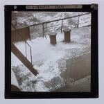
- Classmark: Y3011B(LS)/149
- Title: Tanks. Aden [i.e. Adan]
- Abstract:
A close-up view of some of the stonework in the reservoirs.
- Associated Place(s): Adan (governate); Adan (inhabited place); Asia (continent); South Yemen (region); Yemen (nation)
- Classmark: Y3011B(LS)/150
- Title: Tanks. Aden [i.e. Adan]
- Abstract:
A close-up view of some of the stonework in the reservoirs with a door or sluice at the right.
- Associated Place(s): Adan (governate); Adan (inhabited place); Asia (continent); South Yemen (region); Yemen (nation)
- Classmark: Y3011B(LS)/151
- Title: Aden [i.e. Adan]; Hotel
- Abstract:
An underexposed slide looking along a hotel verandah.
- Associated Place(s): Adan (governate); Adan (inhabited place); Asia (continent); South Yemen (region); Yemen (nation)
- Classmark: Y3011B(LS)/152
- Title: Aden [i.e. Adan] - cricket
- Abstract:
A view showing Arabic boys playing cricket in an open space with low, square buildings beyond.
- Associated Place(s): Adan (governate); Adan (inhabited place); Asia (continent); South Yemen (region); Yemen (nation)
- Classmark: Y3011B(LS)/153
- Title: Seedee boy, Aden [i.e. Adan]
- Abstract:
A view showing a native man relaxing on a boat deck.
- Associated Place(s): Adan (governate); Adan (inhabited place); Asia (continent); South Yemen (region); Yemen (nation)
- Classmark: Y3011B(LS)/154
- Title: Postman's camel
- Abstract:
A view showing a camel tethered outside a building.
- Classmark: Y3011B(LS)/155
- Title: Tame lion, Aden [i.e. Adan]
- Abstract:
A view showing a young lion sitting on a verandah with an unidentified figure standing at the right.
- Associated Place(s): Adan (governate); Adan (inhabited place); Asia (continent); South Yemen (region); Yemen (nation)
- Classmark: Y3011B(LS)/156
- Title: Johore [i.e. Johor]
- Abstract:
A view showing a quayside with residential houses beyond, probably in Johor Baharu.
- Classmark: Y3011B(LS)/157
- Title: Johore [i.e. Johor]
- Abstract:
A canal scene in Johor Baharu with junks in the foreground and buildings in Chinese style beyond.
- Classmark: Y3011B(LS)/158
- Title: Johore [i.e. Johor Baharu] - Sultan's Palace
- Abstract:
A view looking across the lawn towards the palace or Istana, of the Sultan. In the background the flag which denotes that the Sultan is in residence can just be discerned.
- Classmark: Y3011B(LS)/159
- Title: F.M.S. [i.e. Malaysia] - Penang [i.e. George Town] Harbour Entrance
- Abstract:
A view from the sea looking towards the harbour channel. 'F.M.S.' is an abbreviation for 'Federated Malay States'.
- Classmark: Y3011B(LS)/160
- Title: Hong Kong - Entrance
- Abstract:
A view showing two junks off Hong Kong.
- Associated Place(s): Asia (continent); China (nation); Hong Kong (administrative region); Hong Kong (island); Hong Kong Island (area)
- Classmark: Y3011B(LS)/161
- Title: [Panorama of Hong Kong]
- Abstract:
75 x 14 mm. A view from Kowloon looking towards the Victoria waterfront with the Victoria Peak rising beyond.
- Classmark: Y3011B(LS)/162
- Title: The 'Empress of Canada' at Kowloon Wharf
- Abstract:
A copy of a half-tone photograph showing the large liner berthed at Kowloon, with a row of taxi-cabs in the foreground.
- Classmark: Y3011B(LS)/163
- Title: SS 'Kwong Sai' at Stonecutter's Island [i.e. Ngong Shuen Chau]
- Abstract:
A view showing the wrecked ferryboat lying near rocks off Ngong Shuen Chau (West of Kowloon).
- Classmark: Y3011B(LS)/164
- Title: SS 'Chung Ou' wrecked in Kowloon Bay
- Abstract:
A view showing the beached boat lying just offshore.
- Classmark: Y3011B(LS)/165
- Title: SS 'Yeong Sang' sunk
- Abstract:
A view showing only the two masts and the funnel of the 'Yeong Sang' projecting out of the water.
- Classmark: Y3011B(LS)/166
- Title: [Capsized submarine, Hong Kong]
- Abstract:
A view showing a listing and partially submerged submarine lashed to two barges. Another submarine can be partially seen at the right of the slide. The exact nature of the incident is unknown.
- Associated Place(s): Asia (continent); China (nation); Hong Kong (administrative region); South China Sea (sea)
- Classmark: Y3011B(LS)/167
- Title: Panorama of the Peak. Hong Kong
- Abstract:
A view from Kowloon looking towards the Victoria waterfront. Prominent on the shoreline are the headquarters of Siemessen and Co (the second to the right of the large white buildings) the oldest German firm in the Colony, which started business in China in 1846. The building is situated near the junction of Wardley Street and Chater Road. St John's Cathedral can be seen behind the waterfront.
- Classmark: Y3011B(LS)/168
- Title: Panorama of the Peak, further east
- Abstract:
A view showing the Naval dockyard and breakwater, with the military hospital visible at the left on the hill behind Victoria.
- Classmark: Y3011B(LS)/169
- Title: Hong Kong's business section and Harbour with Kowloon beyond
- Abstract:
A copy of a half-tone photograph looking down from Victoria Peak, over Victoria and towards Kowloon with the Naval dockyard visible at the right of the slide.
- Classmark: Y3011B(LS)/170
- Title: University of Hong Kong
- Abstract:
A copy of a half-tone photograph showing the imposing façade of the university, founded by Lord Lugard and formally opened in March 1911.
- Associated Place(s): Asia (continent); China (nation); Hong Kong (administrative region); Hong Kong (island); Hong Kong Island (area)
- Classmark: Y3011B(LS)/171
- Title: Hong Kong and Shanghai Bank
- Abstract:
A view showing the front façade of the bank, from Queen's Road, with a fountain in the foreground.
- Classmark: Y3011B(LS)/172
- Title: The Supreme Court, Hong Kong
- Abstract:
A copy of the half-tone photograph showing the west façade of the Law Courts from Chater Road.
- Classmark: Y3011B(LS)/173
- Title: The Cenotaph and Statue Square
- Abstract:
A copy of a half-tone photograph showing the Cenotaph Statue in Statue Square with the Queen's statue and Siemessen and Co.'s headquarters in the background.
- Classmark: Y3011B(LS)/174
- Title: A principal street in Hong Kong [Pedder Street]
- Abstract:
A copy of a half-tone photograph showing Pedder Street. On the right is the Hongkong Hotel, further down is Hotel Mansions / Union Building, and beyond that is Connaught Road and the harbour. The last building on the left with the tower is Jardine House. The image is undated but might be from the 1930s due to the absence of sedan chairs and rickshaws, and the types of cars present (source for the identification of buildings: Klaus Liphard, contributor to Gwulo: Old Hong Kong).
- Classmark: Y3011B(LS)/175
- Title: The Peak Tramway
- Abstract:
A copy of a half-tone photograph showing a tramcar ascending Victoria Peak on the steep track which runs from near St John's Cathedral up to the Peak Hotel. The line was opened in 1888.
- Classmark: Y3011B(LS)/176
- Title: [The Peak Tramway]
- Abstract:
A view showing a lower section of the tramway with residential houses in the foreground.
- Classmark: Y3011B(LS)/177
- Title: [(?) Connaught Road]
- Abstract:
A view looking along the street with building work in progress at the right and a placard announcing the site of the new Asiatic Petroleum Company's offices in the background.
- Classmark: Y3011B(LS)/178
- Title: [Unidentified building, Hong Kong]
- Abstract:
A view showing an unidentified flat-iron shaped building in Victoria.
- Classmark: Y3011B(LS)/179
- Title: [Victoria and Kowloon]
- Abstract:
A view looking down on Victoria from Victoria Peak with Kowloon in the distance.
- Classmark: Y3011B(LS)/180
- Title: [Connaught Road]
- Abstract:
A view looking east along Connaught Road with a statue of the Duke of Connaught in the foreground. The buildings have been identified as follows, from right to left: Hotel Mansions / Union Building [1905-1961]; St. George's Building (1st Generation) [1904-1966]; King's Building [1905-1958]; Queen's Building [1899-1961]; back left: Central Star Ferry Pier (2nd Location, Connaught Rd off Ice House St) [1912-1958]. The Central Star Ferry Pier was constructed between 1911-1912, hence the photograph is thought to date to c. 1912-1915. The statue of the Duke of Connaught was transferred from Statue Square to this spot on Connaught Road in 1907 to make way for a statue of King Edward VII in Statue Square. [Source for additional information, identification of buildings and date: Klaus Liphard, Gwulo: Old Hong Kong).
- Classmark: Y3011B(LS)/181
- Title: [(?) Connaught Road]
- Abstract:
A view looking west along (?) Connaught Road with the British-American Tobacco Company's offices on the left and moored boats to the right.
- Classmark: Y3011B(LS)/182
- Title: [View from the Park]
- Abstract:
A view from the Ladies Recreation Ground looking across the Albany Filter Beds and along the side of Victoria Peak. The houses at the left are the mansions along MacDonnell Street.
- Classmark: Y3011B(LS)/183-245
- Title: Hong Kong, China and Japan
- Abstract:
Slides 237-244 are copies of prints by Hiroshige. Numbers 246-249 have not been used.
- Associated Place(s): Asia (continent); Bluff Head (headland); Canton (inhabited place); Chih-lung Shih (municipality); Chi-lung (inhabited place); China (nation); Chu (river); Guangdong (province); Hakone (inhabited place); Hok Tsui (headland); Hong Kong (administrative region); Hong Kong (island); Hong Kong Island (area); Honshu (island); Hyogo (prefecture); Japan (nation); Kanagawa-ken (prefecture); Kanto (region); Kinki (region); Kobe (inhabited place); Kowloon Peninsula (peninsula); Kyoto (inhabited place); Kyoto (urban prefecture); Luzon (island); Malay Archipelago (general region); Manila (inhabited place); Manila (region); Philippines (nation); Shandong (province); T'ai-pei Hsien (county); T'ai-wan (island); Taiwan (nation); Takarazuka (inhabited place); Victoria (inhabited place); Victoria Peak (mountain); Weihai (inhabited place)
- Classmark: Y3011B(LS)/183
- Title: [(?) Path in the Public Gardens, Hong Kong]
- Abstract:
A view looking along a tree-shaded path; exact location unknown.
- Classmark: Y3011B(LS)/184
- Title: Hong Kong from [Victoria] Peak
- Abstract:
A view from Victoria Peak looking down on Victoria and the Harbour and across to Kowloon.
- Classmark: Y3011B(LS)/185
- Title: Hong Kong - [Victoria] Peak
- Abstract:
A view looking down from Victoria Peak with an unidentified large white house in the foreground.
- Classmark: Y3011B(LS)/186
- Title: Hong Kong - View from Peak
- Abstract:
A view from Mount Collinson looking over the south eastern section of Hong Kong Island and showing the Dragon's Back and Hok Tsui with Bluff Head in the distance. The large building at the right of the slide is unidentified.
- Classmark: Y3011B(LS)/187
- Title: Hong Kong from [Victoria] Peak
- Abstract:
A view looking down on the city and Harbour of Victoria and showing the Albany Filter Beds (at right of slide), MacDonnell Road (below the filter beds) and the breakwater of the Naval Dockyard. A photograph taken from near the Peak Road.
- Classmark: Y3011B(LS)/188
- Title: Hong Kong from [Victoria] Peak
- Abstract:
A view looking down on Victoria from Victoria Peak with the Harbour and Kowloon beyond.
- Classmark: Y3011B(LS)/189
- Title: Hong Kong - [Victoria] Peak Barracks
- Abstract:
A view showing the large barracks on Victoria Peak, formerly a hotel but purchased by the Royal Artillery circa 1896.
- Classmark: Y3011B(LS)/190
- Title: Hong Kong - [Victoria] Peak Barracks
- Abstract:
A view showing the Victoria Peak Barracks.
- Classmark: Y3011B(LS)/191
- Title: Hong Kong - Mr Leefe's house, [Victoria] Peak
- Abstract:
A view showing an imposing residential house on Victoria Peak, probably that of L.N. Leefe who is recorded as an assistant at Jardine, Matheson and Co (see ?).
- Classmark: Y3011B(LS)/192
- Title: Hong Kong - [Victoria] Peak
- Abstract:
A view looking over the flagstaff on Victoria Peak with Victoria and the Harbour in the distance below.
- Classmark: Y3011B(LS)/193
- Title: Hong Kong - Governor's Ho;, [Victoria] Peak
- Abstract:
A view looking down on Government House from the Upper Albert Road with the Kowloon Peninsula visible in the distance.
- Classmark: Y3011B(LS)/194
- Title: Hong Kong - Governor's House, [Victoria] Peak
- Abstract:
A view showing a wing of Government House, partially obscured by trees.
- Classmark: Y3011B(LS)/195
- Title: Hong Kong
- Abstract:
A view looking along Pedder Street in Victoria, with carts and rickshaws in the roadway. (source for the identification of the street: Klaus Liphard, contributor to Gwulo: Old Hong Kong).
- Classmark: Y3011B(LS)/196
- Title: Hong Kong
- Abstract:
A view along Ice House Lane, off Queen's Road, Victoria, with a row of sedan chairs parked at the right of the street. At the end of the lane can be seen the studio of Mee Cheung, a Chinese commercial photographer who advertises his premises in the 'Directory and Chronicle for China' (1901 ed) as being located at 'Top floor of Ice House'.
- Classmark: Y3011B(LS)/197
- Title: Hong Kong
- Abstract:
A rather blurred view showing four Chinese carrying two sedan chairs.
- Associated Place(s): Asia (continent); China (nation); Hong Kong (administrative region); Hong Kong (island); Hong Kong Island (area)
- Classmark: Y3011B(LS)/198
- Title: Hong Kong - Flower Mkt
- Abstract:
A view looking along tree-shaded Wyndham Street (off Queen's Road), with flower sellers on the pavement.
- Classmark: Y3011B(LS)/199
- Title: Hong Kong
- Abstract:
An unidentified street scene in Hong Kong with sedan chairs and pedestrians in the foreground. The shop signs include those of two photographers, Tai Woo and Hung Choung.
- Classmark: Y3011B(LS)/200
- Title: Hong Kong: House on [Victoria] Peak
- Abstract:
A view showing a long narrow room furnished with chairs and potted plants.
- Classmark: Y3011B(LS)/201
- Title: [Beach scene, (?) Hong Kong]
- Abstract:
A view showing a sandy beach with beach chalets in the foreground and a (?) hotel beyond.
- Associated Place(s): Asia (continent); China (nation); Hong Kong (administrative region); Hong Kong (island); Hong Kong Island (area)
- Classmark: Y3011B(LS)/202
- Title: [Beach scene, (?) Hong Kong]
- Abstract:
A panoramic view of a beach.
- Associated Place(s): Asia (continent); China (nation); Hong Kong (administrative region); Hong Kong (island); Hong Kong Island (area)
- Classmark: Y3011B(LS)/203
- Title: Hong Kong - Canton [i.e. Chu] River
- Abstract:
A view showing a houseboat on the Chu River.
- Associated Place(s): Asia (continent); China (nation); Chu (river); Guangdong (province); Hong Kong (administrative region)
- Classmark: Y3011B(LS)/204
- Title: Hong Kong - Canton [i.e. Chu] River
- Abstract:
A view showing a crowded settlement of warehouses and huts on the bank of the Chu River.
- Associated Place(s): Asia (continent); China (nation); Chu (river); Guangdong (province); Hong Kong (administrative region)
- Classmark: Y3011B(LS)/205
- Title: Hong Kong - Canton [i.e. Chu] River
- Abstract:
A view along the river bank.
- Associated Place(s): Asia (continent); China (nation); Chu (river); Guangdong (province); Hong Kong (administrative region)
- Classmark: Y3011B(LS)/206
- Title: [(?) Canton [i.e. Chu] River]
- Abstract:
A view showing a crowded settlement of sampans, probably on the Chu River, with a bridge and a small island in the background.
- Classmark: Y3011B(LS)/207
- Title: Hong Kong - Canton [i.e. Chu] River
- Abstract:
A view showing three-masted junks on the Chu River, a good composition spoiled through lack of tonal contrast.
- Associated Place(s): Asia (continent); China (nation); Chu (river); Guangdong (province); Hong Kong (administrative region)
- Classmark: Y3011B(LS)/208
- Title: Hong Kong - Canton [i.e. Chu] River
- Abstract:
A rear-view of a junk on the Chu River, with a village on the bank in the background.
- Associated Place(s): Asia (continent); China (nation); Chu (river); Guangdong (province); Hong Kong (administrative region)
- Classmark: Y3011B(LS)/209
- Title: Hong Kong - Canton [i.e. Chu] River
- Abstract:
A murky view showing two junks, possibly transporting a large raft of timber down river.
- Associated Place(s): Asia (continent); China (nation); Chu (river); Guangdong (province); Hong Kong (administrative region)
- Classmark: Y3011B(LS)/210
- Title: Hong Kong - Canton [i.e. Chu] River Boat
- Abstract:
A view showing a river boat of the Sun Ning Railway Co at a jetty on the Chu River.
- Associated Place(s): Asia (continent); China (nation); Chu (river); Guangdong (province); Hong Kong (administrative region)
- Classmark: Y3011B(LS)/211
- Title: [Canton [i.e. Chu] River]
- Abstract:
A well composed photograph showing a junk in the wide Chu River estuary.
- Classmark: Y3011B(LS)/212
- Title: [Junks on the Canton [i.e. Chu] River]
- Abstract:
A view showing junks on the river with mountains on the farther shore.
- Classmark: Y3011B(LS)/213
- Title: [Junks on the Canton [i.e. Chu] River]
- Abstract:
A good head-on view of a junk on the Chu River.
- Classmark: Y3011B(LS)/214
- Title: Chinese boats on Canton [i.e. Chu] River
- Abstract:
A view showing a crowded settlement of sampans on the Chu River.
- Classmark: Y3011B(LS)/215
- Title: Boats on Canton [i.e. Chu] River
- Abstract:
Two photographs mounted together showing (a) a sampan and (b) a passenger boat [junk].
- Classmark: Y3011B(LS)/216
- Title: Birds-eye view of Canton
- Abstract:
A view looking over the Canton rooftops. The devastation of many of the houses visible in the photograph is presumably attributable to one or more of the many revolutionary uprisings which took place in Canton from 1911 onwards.
- Associated Place(s): Asia (continent); Canton (inhabited place); China (nation); Guangdong (province)
- Classmark: Y3011B(LS)/217
- Title: River front, Canton
- Abstract:
A view showing the large and crowded settlement on the river frontage at Canton.
- Associated Place(s): Asia (continent); Canton (inhabited place); China (nation); Chu (river); Guangdong (province)
- Classmark: Y3011B(LS)/218
- Title: Medley of traffic in Canton
- Abstract:
A view showing rickshaws and a motor car in a Canton street.
- Associated Place(s): Asia (continent); Canton (inhabited place); China (nation); Guangdong (province)
- Classmark: Y3011B(LS)/219
- Title: Sun Building Canton
- Abstract:
A view from the river showing business premises on the waterfront with moored boats in the foreground. The large Sun Building in the centre of the slide is presumably named after Sun Yat Sen.
- Associated Place(s): Asia (continent); Canton (inhabited place); China (nation); Guangdong (province)
- Classmark: Y3011B(LS)/220
- Title: Canton Christian College
- Abstract:
A view looking over the well-tended lawn and garden towards the College buildings.
- Associated Place(s): Asia (continent); Canton (inhabited place); China (nation); Guangdong (province)
- Classmark: Y3011B(LS)/221
- Title: Inauguration of Sun Yat Sen
- Abstract:
A view showing crowds of Chinese carrying banners and placards in the streets of Canton. A photograph presumably taken at Sun Yat Sen's first accession to power in China in 1911.
- Date of Creation: 1911
- Associated Place(s): Asia (continent); Canton (inhabited place); China (nation); Guangdong (province)
- Classmark: Y3011B(LS)/222
- Title: A reproduction of a manifesto inspired by the May 30 Movement
- Abstract:
A photographic copy of a one page manifesto demanding the repeal of racially discriminatory laws, issued on the anniversary of the 'May 30 tragedy' (exact incident referred to unknown).
- Date of Creation: 1926
- Associated Place(s): Asia (continent); China (nation)
- Classmark: Y3011B(LS)/223
- Title: The Navy Political Pictorial No. 2
- Abstract:
This is a special anti-Christian issue of the periodical probably inspired by the May 30 Movement. The cartoon’s caption may be translated as ‘Christianity, like hypnotism, is used by imperialists on weak peoples, making them lose their souls without knowing it’.
- Author(s): Navy Political Division
- Date of Creation: 1925
- Associated Place(s): Asia (continent); China (nation)
- Classmark: Y3011B(LS)/224
- Title: The Navy Political Pictorial No. 3
- Abstract:
This is a special anti-Christian issue of the periodical probably inspired by the May 30 Movement. The cartoon’s caption may be translated as ‘When the imperialists oppress weak people, Christians say to the oppressed: “endure when oppressed, after the left cheek, (offer) the right one.” Christian fraternity and peace defend the doctrine of imperialism.’
- Author(s): Navy Political Division
- Date of Creation: 1925
- Associated Place(s): Asia (continent); China (nation)
- Classmark: Y3011B(LS)/225
- Title: The Navy Political Pictorial No. 5
- Abstract:
This is a special anti-Christian issue of the periodical probably inspired by the May 30 Movement. The cartoon’s caption may be translated as ‘The Shanghai Christian offered the following prayer in front of the British policeman: ‘God bless you, brave policeman, once I get to court I will testify that your shooting Chinese unarmed masses was in obedience to God’s will.’
- Author(s): Navy Political Division
- Date of Creation: 1925
- Associated Place(s): Asia (continent); China (nation)
- Classmark: Y3011B(LS)/226
- Title: British fleet at Wei-hai-wei [i.e. Weihai]
- Abstract:
A view looking across towards Weihai Harbour (from Liu-Kung-Tao?) where the battleships of the British China Squadron are at anchor. In the foreground are cultivated fields and small houses. Weihai, ceded to the British in 1898 'for so long a period as Port Arthur remains in the occupation of Russia', was the northern naval base of the British China Squadron, and in fact remained in British hands until 1930.
- Associated Place(s): Asia (continent); China (nation); Shandong (province); Weihai (inhabited place)
- Classmark: Y3011B(LS)/227
- Title: Formosa - Keelung [i.e. Taiwan - Chi-lung]
- Abstract:
An indistinct view from the sea showing the harbour and water front of Chi-lung with mountains beyond.
- Classmark: Y3011B(LS)/228
- Title: Formosa - Keelung [i.e. Taiwan - Chi-lung]
- Abstract:
A view showing a rocky promontory and small settlement at Chi-lung on the north coast of T'ai-wan.
- Classmark: Y3011B(LS)/229
- Title: Formosa [i.e. Taiwan]
- Abstract:
A view from the sea showing a harbour and water front, possibly at Chi-lung.
- Classmark: Y3011B(LS)/230
- Title: Formosa - Keelung [i.e. Taiwan - Chi-lung], 1909
- Abstract:
A view from the sea showing the crowded harbour at Chi-lung, with mountains beyond.
- Date of Creation: 1909
- Classmark: Y3011B(LS)/231
- Title: SS 'Indrawadi', Kobe; pilot going over
- Abstract:
A view from the deck of the 'Indrawadi' showing the pilot climbing over the side into a rowing boat.
- Associated Place(s): Asia (continent); Honshu (island); Hyogo (prefecture); Japan (nation); Kinki (region); Kobe (inhabited place)
- Classmark: Y3011B(LS)/232
- Title: Japan - Kioto [i.e. Kyoto]
- Abstract:
A view showing the entrance gateway to a Japanese building, with curved roof and a statue in the foreground.
- Associated Place(s): Asia (continent); Honshu (island); Japan (nation); Kinki (region); Kyoto (inhabited place); Kyoto (urban prefecture)
- Classmark: Y3011B(LS)/233
- Title: Japan - Temple Grove, Hakone
- Abstract:
A view looking along an avenue of tall pine trees at Hakone in central Honshu.
- Associated Place(s): Asia (continent); Hakone (inhabited place); Honshu (island); Japan (nation); Kanagawa-ken (prefecture); Kanto (region)
- Classmark: Y3011B(LS)/234
- Title: Japan - Takaradzuka [i.e. Takarazuka]
- Abstract:
A view looking along a commercial street with goods laid out under awnings. Takarazuka is the entertainment district of Kohoma, 13 miles north-west of Osaka, and is famed for its mineral springs.
- Associated Place(s): Asia (continent); Honshu (island); Hyogo (prefecture); Japan (nation); Kinki (region); Takarazuka (inhabited place)
- Classmark: Y3011B(LS)/235
- Title: Japan - Takaradzuka [i.e. Takarazuka] Baths
- Abstract:
A blurred view showing a stone courtyard outside the entrance to the baths at Takarazuka.
- Associated Place(s): Asia (continent); Honshu (island); Hyogo (prefecture); Japan (nation); Kinki (region); Takarazuka (inhabited place)
- Classmark: Y3011B(LS)/236
- Title: Japan - Temple Grove, Hakone
- Abstract:
A view showing a group of Japanese in an open space beneath tall pine trees at Hakone.
- Associated Place(s): Asia (continent); Hakone (inhabited place); Honshu (island); Japan (nation); Kanagawa-ken (prefecture); Kanto (region)
- Classmark: Y3011B(LS)/237
- Title: Japan. Scene by Hiroshige
- Abstract:
A copy of a print by Ando Hiroshige showing a woman carrying produce along a country road through a river gorge.
- Associated Name(s): Hiroshige, Ando, 1797-1858
- Associated Place(s): Asia (continent); Japan (nation)
- Classmark: Y3011B(LS)/238
- Title: Japan. Scene by Hiroshige
- Abstract:
A copy of a seascape by Hiroshige with a mountainous coastline in the background.
- Associated Name(s): Hiroshige, Ando, 1797-1858
- Associated Place(s): Asia (continent); Japan (nation)
- Classmark: Y3011B(LS)/239
- Title: Japan. Scene by Hiroshige
- Abstract:
A copy of a print by Hiroshige showing travellers crossing a river.
- Associated Name(s): Hiroshige, Ando, 1797-1858
- Associated Place(s): Asia (continent); Japan (nation)
- Classmark: Y3011B(LS)/240
- Title: Japan. Scene by Hiroshige
- Abstract:
A copy of a print by Hiroshige showing a sea side village with a harbour and boats beyond.
- Associated Name(s): Hiroshige, Ando, 1797-1858
- Associated Place(s): Asia (continent); Japan (nation)
- Classmark: Y3011B(LS)/241
- Title: Japan. Scene by Hiroshige
- Abstract:
A copy of a print by Hiroshige showing a sea side village with a harbour and boats beyond.
- Associated Name(s): Hiroshige, Ando, 1797-1858
- Associated Place(s): Asia (continent); Japan (nation)
- Classmark: Y3011B(LS)/242
- Title: Japan. Scene by Hiroshige
- Abstract:
A copy of a print by Hiroshige showing a group of travellers, on horseback, sedan chair and on foot.
- Associated Name(s): Hiroshige, Ando, 1797-1858
- Associated Place(s): Asia (continent); Japan (nation)
- Classmark: Y3011B(LS)/243
- Title: Japan. Scene by Hiroshige
- Abstract:
A copy of a print by Hiroshige showing travellers crossing a river, with mountains in the distance.
- Associated Name(s): Hiroshige, Ando, 1797-1858
- Associated Place(s): Asia (continent); Japan (nation)
- Classmark: Y3011B(LS)/244
- Title: Japan. Scene by Hiroshige
- Abstract:
A copy of a print by Hiroshige showing travellers crossing a long wooden bridge, with mountains in the distance.
- Associated Name(s): Hiroshige, Ando, 1797-1858
- Associated Place(s): Asia (continent); Japan (nation)
- Classmark: Y3011B(LS)/245
- Title: Phillipines - Manila Old City
- Abstract:
A view looking along an unidentified street in Manila with pedestrians and a pony trap in the roadway.
- Associated Place(s): Asia (continent); Luzon (island); Malay Archipelago (general region); Manila (inhabited place); Manila (region); Philippines (nation)
- Classmark: Y3011B(LS)/246
- Title: Houses wrecked at Youmati
- Associated Place(s): Asia (continent); Luzon (island); Malay Archipelago (general region); Manila (inhabited place); Manila (region); Philippines (nation)
- Classmark: Y3011B(LS)/247
- Title: [Damaged buildings at Youmati]
- Associated Place(s): Asia (continent); Luzon (island); Malay Archipelago (general region); Manila (inhabited place); Manila (region); Philippines (nation)
- Classmark: Y3011B(LS)/248
- Title: [Canal scene]
- Associated Place(s): Asia (continent); Luzon (island); Malay Archipelago (general region); Manila (inhabited place); Manila (region); Philippines (nation)
- Classmark: Y3011B(LS)/249
- Title: [Damaged buildings at Youmati]
- Associated Place(s): Asia (continent); Luzon (island); Malay Archipelago (general region); Manila (inhabited place); Manila (region); Philippines (nation)
- Classmark: Y3011B(LS)/250-326
- Title: Dutch East Indies [i.e. Indonesia]
- Date of Creation: circa 1910-circa 1915 (A number of slides are dated 1910, but there is a sequence showing the development of plantations on Belang-Belang Island between 1911 and 1915.)
- Associated Place(s): Aceh (autonomous district); Ambon, Pulau (island); Asia (continent); Bacan, Pulau (island); Bali (island); Bali (province); Balikpapan (inhabited place); Banda, Kepulauan (island group); Bandung (inhabited place); Bogor (inhabited place); Borneo (island); Bromo, Gunung (mountain); Celebes (island); Celebes Sea (sea); Indonesia (nation); Jakarta (inhabited place); Jakarta Raya (metropolitan area); Jawa (island); Jawa Barat (province); Jawa Timur (province); Kalimantan (region (general)); Kalimantan Timur (province); Malay Archipelago (general region); Maluku (province); Manado (inhabited place); Moluccas (island group); Nusa Tenggara (island group); Obi, Kepulauan (island group); Sabang (inhabited place); Sulawesi Selatan (province); Sulawesi Utara (province); Sumatra (island); Ternate (inhabited place); Ternate (island); Ujung Pandang (inhabited place); We, Pulau (island)
- Classmark: Y3011B(LS)/250
- Title: Java. Batavia Roads [i.e. Jawa. Jakarta Roads]
- Abstract:
A view showing ships at anchor in the Jakarta roadstead, with harbour wharves on either side.
- Classmark: Y3011B(LS)/251
- Title: Java. Batavia [i.e. Jawa. Jakarta]
- Abstract:
A view showing two Javanese walking beside one of the many canals that criss-cross Jakarta.
- Classmark: Y3011B(LS)/252
- Title: Java [i.e. Jawa] - H[otel der] Nederlanden
- Abstract:
A view showing a courtyard and part of the hotel premises: 'The Hotel der Nederlanden, established since 1840, is another of the leading hotels in Jakarta. Centrally situated, fronting Rijswijk, it possesses every convenience calculated to ensure the comfort of visitors. Large airy rooms, lighted by electricity, an excellent cuisine, and a well-trained staff of Javanese servants, together with a courteous management combine to make this hotel a most comfortable place to stay at. Large bungalows (consisting of three rooms with private bathrooms attached), ensconsed amid waving palms, are at the disposal of family parties ... The grounds are laid out and the private drives and tasteful walks beautifully shaded. Several languages are spoken and runners from the hotel meet all trains and boats.' (??)
- Classmark: Y3011B(LS)/253
- Title: Java [i.e. Jawa] - H[otel der] Nederlanden, Batavia [i.e. Jakarta]
- Abstract:
A view showing the street and part of the hotel premises.
- Classmark: Y3011B(LS)/254
- Title: Java [i.e. Jawa] - H[otel der] Nederlanden, Batavia [i.e. Jakarta]
- Abstract:
A view along the street with the hotel on the right.
- Classmark: Y3011B(LS)/255
- Title: Java [i.e. Jawa] - H[otel der] Nederlanden, Batavia [i.e. Jakarta]
- Abstract:
A view from the street looking towards the balconied frontage of this small hotel.
- Classmark: Y3011B(LS)/256
- Title: Java [i.e. Jawa] - H[otel der] Nederlanden, Batavia [i.e. Jakarta]
- Abstract:
A view showing the roadway with the hotel premises on the right.
- Classmark: Y3011B(LS)/257
- Title: Bandoeng [i.e. Bandung]. A street
- Abstract:
A view looking along a wide street in Bandung with single-storey shops and houses on either side of the road. Bandung lies 75 miles south-east of Jakarta and was formerly the headquarters of the (then) Dutch East Indies Army.
- Classmark: Y3011B(LS)/258
- Title: Java [i.e. Jawa] and its people. Buitenzorg [i.e. Bogor]. A street
- Abstract:
A view showing a side street in Bogor (formerly known as Buitenzorg) with single storey native dwellings on either side of the street. With a merchant's stall outside a house on the right foreground. Situated 30 miles south of Jakarta, Bogor was primarily famous for its botanical gardens, laid out in 1817. The Governor-General of the (then) Dutch East Indies also had a palace in the town.
- Classmark: Y3011B(LS)/259
- Title: Java [i.e. Jawa]
- Abstract:
A portrait of two Javanese women, one seated and one standing, posed against a cloth backdrop.
- Associated Place(s): Asia (continent); Indonesia (nation); Jawa (island); Malay Archipelago (general region)
- Classmark: Y3011B(LS)/260
- Title: Java - Bromo [i.e. Jawa - Gunung Bromo]
- Abstract:
A view showing the sand sea and the volcanic craters of Gunung Bromo in E Jawa. The print, a copy of a gravure reproduction, is marked with a route in ink. There is also a scribbled note in ink (illegible) beneath the mount.
- Associated Place(s): Asia (continent); Bromo, Gunung (mountain); Indonesia (nation); Jawa Timur (province); Malay Archipelago (general region)
- Classmark: Y3011B(LS)/261
- Title: Java - Bromo [i.e. Jawa - Gunung Bromo], Sand Sea
- Abstract:
A copy of a half-tone print showing two riders on a stretch of sand in the foreground with the crater of Gunung Bromo beyond. The original photograph is in a letter-press beneath the slide.
No further information is available.
- Author(s): Kurkdjian of Sourabaya [i.e. Surabaya]
- Associated Place(s): Asia (continent); Bromo, Gunung (mountain); Indonesia (nation); Jawa Timur (province); Malay Archipelago (general region)
- Classmark: Y3011B(LS)/262
- Title: Celebes Is - Menado [i.e. Manado]
- Abstract:
A view showing natives on a road in Manado with a background of jungle foliage. Manado lies near the tip of the north eastern arm of this strangely shaped island.
- Classmark: Y3011B(LS)/263
- Title: Celebes Is - Menado [i.e. Manado]
- Abstract:
A view looking along a tree-shaded street in Manado with an umbrella-carrying pedestrian walking in the foreground.
- Classmark: Y3011B(LS)/264
- Title: Celebes Is - Menado [i.e. Manado]
- Abstract:
A view looking along a street in Manado with houses on either side of the roadway and passers by watching the camera.
- Classmark: Y3011B(LS)/265
- Title: Celebes Is - Menado [i.e. Manado]
- Abstract:
A view from the sea looking towards houses lining the waterfront at Manado.
- Classmark: Y3011B(LS)/266
- Title: Moluccos Is - Ternate, Volcano
- Abstract:
A view showing a steamship moored to a jetty in Ternate Harbour with the volcano looming in the background. Ternate is one of the smaller Moluccan islands lying off the West coast of Halmahera. A clear, well-composed photograph.
- Classmark: Y3011B(LS)/267
- Title: Moluccos Is - Ternate. 1910
- Abstract:
A view looking aling a tree-shaded street in Ternate.
- Date of Creation: 1910
- Classmark: Y3011B(LS)/268
- Title: Moluccos Is. - Ternate. 1910
- Abstract:
A view looking along a tree-shaded road in Ternate with a group of children gathered in the distance.
- Date of Creation: 1910
- Classmark: Y3011B(LS)/269
- Title: Moluccos Is. - Ternate
- Abstract:
A view looking along a residential street of white washed houses with thatched roofs in Ternate.
- Classmark: Y3011B(LS)/270
- Title: Celebes Is. - Makassar [i.e. Ujung Pandang]
- Abstract:
A view looking along a tree-lined street in Ujung Pandang.
- Classmark: Y3011B(LS)/271
- Title: Moluccos Is, Amboina [i.e. Pulau Ambon]. 1910
- Abstract:
A view showing a farming scene in Pulau Ambon, with cattle in the foreground, a banana plantation beyond and the sea in the distance. Pulau Ambon lies off the south-west coast of Seram, the largest of the Moluccan Islands.
- Date of Creation: 1910
- Classmark: Y3011B(LS)/272
- Title: Banda I: - Off New Guinea - Volcano
- Abstract:
An interesting view showing Banda Island natives in long war canoes with decorated prows with the volcano rising from the shore beyond. The island seen here is Gunung Api, one of the smaller islands of the Banda group which lies about 50 miles south of Seram.
- Classmark: Y3011B(LS)/273
- Title: Banda I: Off New Guinea
- Abstract:
A view showing a native village built on the shore of a curving beach. Exact location unknown.
- Classmark: Y3011B(LS)/274
- Title: H.H. the Sultan of Batjan [i.e. Pulau Bacan] and W.D
- Abstract:
An interior view showing the two men seated at a table in wicker-chairs in a room hung with cane screens. With a billiard table in the background. Pulau Bacan is situated about 10 miles south west of Halmahera.
- Classmark: Y3011B(LS)/275
- Title: Batjan [i.e. Pulau Bacan]- Sultan, W.D., H.P.A
- Abstract:
A posed portrait group of five men in a garden: WD and HPA stand behind the seated Sultan and beside two unidentified Moluccans, possibly servants.
- Classmark: Y3011B(LS)/276
- Title: Batjan [i.e. Pulau Bacan], H.H. Sultan, WD, HPA, 1910
- Abstract:
A posed portrait of five men in a garden; in addition to those identified, there are two unidentified Moluccans, possibly servants.
- Date of Creation: 1910
- Classmark: Y3011B(LS)/277
- Title: Batjan [i.e. Pulau Bacan] - Sultan and group
- Abstract:
A posed portrait of five men in a garden; in addition to those identified, there are two unidentified Moluccans, possibly servants.
- Classmark: Y3011B(LS)/278
- Title: Batjan I. [i.e. Pulau Bacan], Moluccos - The Bay, 1910
- Abstract:
A well composed view looking along the waterfront with a native village on the shoreline. Exact location unknown.
- Date of Creation: 1910
- Classmark: Y3011B(LS)/279
- Title: Batjan [i.e. Pulau Bacan] - Our Bay
- Abstract:
A view showing a curving bay with a settlement on the shore and native boats in the foreground. Exact location unknown.
- Classmark: Y3011B(LS)/280
- Title: Batjan [i.e. Pulau Bacan], Moluccos Islands
- Abstract:
A badly exposed plate of a view showing a long native canoe paddling out to meet a small steamer to sell Dammar, a resin used in caulking ships.
- Classmark: Y3011B(LS)/281
- Title: Batjan [i.e. Pulau Bacan], Loading Damar
- Abstract:
A view showing a long native canoe paddling out to meet a small steamer to sell Dammar, a resin used in caulking ships.
- Classmark: Y3011B(LS)/282
- Title: Batjan [i.e. Pulau Bacan]
- Abstract:
A view showing thatched native huts among coconut palms.
- Classmark: Y3011B(LS)/283
- Title: Batjan [i.e. Pulau Bacan] - Fort
- Abstract:
A rather indistinct slide showing part of an unidentified fort presumably connected with the Dutch occupation of the island, first settled in by the Netherlands in 1609 and by 1667 completely under their control.
- Classmark: Y3011B(LS)/284
- Title: Batjan [i.e. Pulau Bacan], Moluccos Is: 1910
- Abstract:
A view showing a wooden bridge over a river in Pulau Bacan. Exact location unidentified.
- Date of Creation: 1910
- Classmark: Y3011B(LS)/285
- Title: Batjan [i.e. Pulau Bacan] - Englishman's Grave
- Abstract:
A view showing a stone cross marking the grave of an unidentified Englishman.
- Classmark: Y3011B(LS)/286
- Title: Borneo East. Balik Papan [i.e. Balikpapan]
- Abstract:
A view looking down on the harbour facilities at Balikpapan with ships moored at the end of long jetties which stretch out into the harbour and with a native settlement on the shoreline in the background. Balikpapan lies on the Macassar Strait coastline of Kalimantan Timur.
- Classmark: Y3011B(LS)/287
- Title: Belang-Beland Island (Moluccas Archipelago); First landing
- Abstract:
A view showing a European with an Asian in European clothes beside him on a beach; a boat is drawn up at the waterline and a steam vessel is visible off shore. Belang-Belang is one of the Kepulauan Obi, an island group in the Northern Moluccas.
- Classmark: Y3011B(LS)/288
- Title: Belang-Belang Island
- Abstract:
A view of the east shore of the island.
- Classmark: Y3011B(LS)/289
- Title: Belang-Belang Island
- Abstract:
A view of the east shore of the island.
- Classmark: Y3011B(LS)/290
- Title: Belang-Belang Island
- Abstract:
A view of the north-east of the island.
- Classmark: Y3011B(LS)/291
- Title: Belang-Belang Island
- Abstract:
A view of the north of the island.
- Classmark: Y3011B(LS)/292
- Title: Belang-Belang Island
- Abstract:
A view of the north of the island.
- Classmark: Y3011B(LS)/293
- Title: Belang-Belang Island
- Abstract:
A view of a lagoon on the south shore of the island.
- Classmark: Y3011B(LS)/294
- Title: Belang-Belang Island. N.E. Shore, showing jungle before clearing. March 1911
- Date of Creation: Mar. 1911
- Classmark: Y3011B(LS)/295
- Title: Belang-Belang Island. S.S. 'Laga' lying at Pier on N.E. end of Island. 1915
- Date of Creation: 1915
- Classmark: Y3011B(LS)/296
- Title: Belang-Belang Island. Coconut Palm (Bali seed) planted May 1912; 3 years old
- Date of Creation: May 1912
- Classmark: Y3011B(LS)/297
- Title: Belang-Belang I: Coconut Palms - from Bali seed-nuts. Four years old. May, 1912
- Date of Creation: May 1912
- Classmark: Y3011B(LS)/298
- Title: Belang-Belang Island. Cemented well and Coconut Palm from Bali seed-nut. Nov. 1915
- Date of Creation: Nov. 1915
- Classmark: Y3011B(LS)/299
- Title: Belang-Belang Island. Site reserved for Copra Factory, after clearing and burning Island. 1915
- Date of Creation: 1915
- Classmark: Y3011B(LS)/300
- Title: Belang-Belang Island. Timber Reserve, showing Marsh, drying and then fit for planting. 1915
- Date of Creation: 1915
- Classmark: Y3011B(LS)/301
- Title: Belang-Belang Island. 'Nursery', and one-year-old Coconut Palms; Batjan [i.e. Bacan] and Ternate seed-nuts. 1915
- Date of Creation: 1915
- Classmark: Y3011B(LS)/302
- Title: Bali - Temple entrance
- Abstract:
A view showing ornate stone carvings on the entrance doorway of an unidentified temple.
- Associated Place(s): Asia (continent); Bali (island); Bali (province); Indonesia (nation); Malay Archipelago (general region); Nusa Tenggara (island group)
- Classmark: Y3011B(LS)/303
- Title: Bali - Temple Entrance
- Abstract:
A view showing a row of steps, flanked by stone statues, leading up towards a pagoda-like tower. Exact location unidentified.
- Associated Place(s): Asia (continent); Bali (island); Bali (province); Indonesia (nation); Malay Archipelago (general region); Nusa Tenggara (island group)
- Classmark: Y3011B(LS)/304
- Title: Bali - Ancient sacred figures
- Abstract:
A view showing a circle of carved stone figures of human forms.
- Associated Place(s): Asia (continent); Bali (island); Bali (province); Indonesia (nation); Malay Archipelago (general region); Nusa Tenggara (island group)
- Classmark: Y3011B(LS)/305
- Title: Bali - Village
- Abstract:
A view looking over the rooftops of a Balinese village with jungle beyond.
- Associated Place(s): Asia (continent); Bali (island); Bali (province); Indonesia (nation); Malay Archipelago (general region); Nusa Tenggara (island group)
- Classmark: Y3011B(LS)/306
- Title: Bali Isld - Interior
- Abstract:
A view looking across a lake towards distant mountains with two women on the nearer shore in the foreground. Photograph by Kurkdjian of Sourabaya.
No further information is available.
- Author(s): Kurkdjian of Sourabaya
- Associated Place(s): Asia (continent); Bali (island); Bali (province); Indonesia (nation); Malay Archipelago (general region); Nusa Tenggara (island group)
- Classmark: Y3011B(LS)/307
- Title: [Bali Isld - Interior]
- Abstract:
A glass copy-negative, signed by Kurkdjian of Sourabaya.
- Associated Place(s): Asia (continent); Bali (island); Bali (province); Indonesia (nation); Malay Archipelago (general region); Nusa Tenggara (island group)
- Classmark: Y3011B(LS)/308
- Title: Sumatra - Sabang
- Abstract:
A view from the sea showing the harbour frontage and warehouses at Sabang. Sabang lies on the small island of Pulau We just north of Sumatra and is an important coaling station.
- Classmark: Y3011B(LS)/309
- Title: Sumatra - Sabang
- Abstract:
A view looking across an open, grassed space with houses and warehouses beyond. Exact location unidentified.
- Classmark: Y3011B(LS)/310
- Title: Sumatra Sabang
- Abstract:
A view looking along a wharf at Sabang towards a moored ship.
- Classmark: Y3011B(LS)/311
- Title: Sumatra; Sabang
- Abstract:
A view from the sea looking towards wharves and moored ships at Sabang with overhead gantries and cranes.
- Classmark: Y3011B(LS)/312
- Title: Sumatra; Sabang
- Abstract:
A view looking towards jetties and warehouses at Sabang.
- Classmark: Y3011B(LS)/313
- Title: Sumatra - Sabang
- Abstract:
A view looking down on a curving bay with houses and jetties on the shoreline.
- Classmark: Y3011B(LS)/314
- Title: Sumatra - Sabang
- Abstract:
A view showing native workers carrying wicker baskets on a jetty at Sabang during coaling operations.
- Classmark: Y3011B(LS)/315
- Title: Sumatra - Sabang
- Abstract:
A view showing ships moored to a jetty at Sabang with part of the hull of the 'Indrawadi' visible at the left of the slide.
- Classmark: Y3011B(LS)/316
- Title: Sumatra; coaling at Sabang
- Abstract:
A view showing a ship (probably the 'Indrawadi') moored at a wharf at Sabang, with gantries at the right of the slide.
- Classmark: Y3011B(LS)/317
- Title: Sumatra; Sabang
- Abstract:
A view showing native workers carrying wicker baskets filled with coal onto a moored ship (probably the 'Indrawadi').
- Classmark: Y3011B(LS)/318
- Title: Sumatra, Sabang; an octopus
- Abstract:
A view showing a ship's officer and a native man holding up an octopus for the camera.
- Classmark: Y3011B(LS)/319
- Title: Sumatra, Sabang
- Abstract:
An underexposed print showing a ship's officer standing in a shady square in Sabang with a bar in the background.
- Classmark: Y3011B(LS)/320
- Title: Sumatra; Sabang
- Abstract:
A view looking along a street in Sabang with parkland and trees at the right of the slide.
- Classmark: Y3011B(LS)/321
- Title: Sumatra - Sabang
- Abstract:
A view showing a stone gateway and a tree in Sabang with grassland beyond. Presumably the remains of a more extensive wall.
- Classmark: Y3011B(LS)/322
- Title: Sumatra, Sabang, 1909
- Abstract:
A view showing a white-suited figure standing in a roadway in Sabang with a large white house and palm trees behind him.
- Date of Creation: 1909
- Classmark: Y3011B(LS)/323
- Title: Sumatra; leaving Sabang; 1909
- Abstract:
A view showing W.D. rather stiffly posed on the deck of the 'Indrawadi' with the island Pulau We in the background.
- Date of Creation: 1909
- Classmark: Y3011B(LS)/324
- Title: Wreck SS 'Band' on Reef, 'Cape Rivers', N.W. Celebes, June 26 1910
- Abstract:
View showing the wrecked ship.
- Date of Creation: 26 June 1910
- Associated Place(s): Asia (continent); Celebes Sea (sea); Indonesia (nation); Malay Archipelago (general region)
- Classmark: Y3011B(LS)/325
- Title: Wreck SS 'Band' on Reef, 'Cape Rivers', N.W. Celebes, June 26 1910
- Abstract:
View showing the wrecked ship.
- Date of Creation: 26 June 1910
- Associated Place(s): Asia (continent); Celebes Sea (sea); Indonesia (nation); Malay Archipelago (general region)
- Classmark: Y3011B(LS)/326
- Title: Wreck SS 'Band' on Reef, 'Cape Rivers', N.W. Celebes, June 26 1910
- Abstract:
View showing the wrecked ship.
- Date of Creation: 26 June 1910
- Associated Place(s): Asia (continent); Celebes Sea (sea); Indonesia (nation); Malay Archipelago (general region)
- Classmark: Y3011B(LS)/327-419
- Title: Ceylon [i.e. Sri Lanka] 1910-11
- Abstract:
Includes a number of photographs of tea estates.
- Date of Creation: 1910-1911
- Associated Place(s): Asia (continent); Central Province (province); Eastern Province (province); Jaffna (inhabited place); Kandy (inhabited place); Matale (inhabited place); North Central Province (province); Northern Province (province); Polonnaruwa (inhabited place); Sri Lanka (nation); Western Province (province)
- Classmark: Y3011B(LS)/327
- Title: Ceylon [i.e. Sri Lanka] - Polonnaruwa
- Abstract:
A view showing two unidentified Europeans carrying shotguns and three Sri Lankan servants.
- Associated Place(s): Asia (continent); North Central Province (province); Polonnaruwa (inhabited place); Sri Lanka (nation)
- Classmark: Y3011B(LS)/328
- Title: Ceylon [i.e. Sri Lanka] - Polonnaruwa
- Abstract:
A view of the rest house at Polonnaruwa, a verandahed bungalow on a small incline.
- Associated Place(s): Asia (continent); North Central Province (province); Polonnaruwa (inhabited place); Sri Lanka (nation)
- Classmark: Y3011B(LS)/329
- Title: Ceylon [i.e. Sri Lanka] - Polonnaruwa Rest House
- Abstract:
A view of the rest house at Polonnaruwa with trees in the foreground.
- Associated Place(s): Asia (continent); North Central Province (province); Polonnaruwa (inhabited place); Sri Lanka (nation)
- Classmark: Y3011B(LS)/330
- Title: Ceylon [i.e. Sri Lanka] - Polonnaruwa
- Abstract:
A view looking across a wide curving river towards distant mountains.
- Associated Place(s): Asia (continent); North Central Province (province); Polonnaruwa (inhabited place); Sri Lanka (nation)
- Classmark: Y3011B(LS)/331
- Title: Ceylon [i.e. Sri Lanka] - Polonnaruwa
- Abstract:
A rather indistinct view showing cattle in a field.
- Associated Place(s): Asia (continent); North Central Province (province); Polonnaruwa (inhabited place); Sri Lanka (nation)
- Classmark: Y3011B(LS)/332
- Title: Ceylon [i.e. Sri Lanka] - Polonnaruwa
- Abstract:
A view showing the Wata Dage and the Thuparama in the ruined city of Polonnaruwa. The Wata Dage, or Round House, are the circular halls built by King Karakrama. The Thuparama (left of slide) is a temple built in oblong form with a low, square tower.
Polonnaruwa, situated in the North Central Province of Sri Lanka, 50 miles south-east of Anuradhapura, had been a royal residence of the rulers of Sri Lanka since 368 AD. It was only with the sacking of Anuradhapura by the Tamils in the 8th century that Polonnaruwa became the capital. Polonnaruwa itself was sacked in the 11th century and the ruins that these slides depict date from the 12th century and the reign of Parakrama Bahu (the Great).
- Associated Place(s): Asia (continent); North Central Province (province); Polonnaruwa (inhabited place); Sri Lanka (nation)
- Classmark: Y3011B(LS)/333
- Title: Ceylon [i.e. Sri Lanka] - Polonnaruwa
- Abstract:
A view showing the ruins of the Jetawanarama temple with a large statue of Buddha (lacking a head) on the rear wall.
- Associated Place(s): Asia (continent); North Central Province (province); Polonnaruwa (inhabited place); Sri Lanka (nation)
- Classmark: Y3011B(LS)/334
- Title: Ceylon [i.e. Sri Lanka] - Polonnaruwa
- Abstract:
A view showing an unidentified ruin and various statues.
- Associated Place(s): Asia (continent); North Central Province (province); Polonnaruwa (inhabited place); Sri Lanka (nation)
- Classmark: Y3011B(LS)/335
- Title: Ceylon [i.e. Sri Lanka] - Polonnaruwa
- Abstract:
A view looking across the overgrown foundations of buildings towards a modern bungalow, probably the rest house.
- Associated Place(s): Asia (continent); North Central Province (province); Polonnaruwa (inhabited place); Sri Lanka (nation)
- Classmark: Y3011B(LS)/336
- Title: Ceylon [i.e. Sri Lanka] - Polonnaruwa
- Abstract:
A view looking towards the Kiri or Milk dagoba.
- Associated Place(s): Asia (continent); North Central Province (province); Polonnaruwa (inhabited place); Sri Lanka (nation)
- Classmark: Y3011B(LS)/337
- Title: Ceylon [i.e. Sri Lanka] - Polonnaruwa
- Abstract:
A view showing an unidentified temple standing atop a small but steep hill and surmounted by a conical tower.
- Associated Place(s): Asia (continent); North Central Province (province); Polonnaruwa (inhabited place); Sri Lanka (nation)
- Classmark: Y3011B(LS)/338
- Title: Ceylon [i.e. Sri Lanka] - Polonnaruwa
- Abstract:
A view looking along the entrance steps of a ruined temple towards the carved statue of a seated Buddha.
- Associated Place(s): Asia (continent); North Central Province (province); Polonnaruwa (inhabited place); Sri Lanka (nation)
- Classmark: Y3011B(LS)/339
- Title: Ceylon [i.e. Sri Lanka] - Buddha, Polonnaruwa
- Abstract:
A view showing a huge statue (about 24 feet high) of Buddha carved from a rock face at the Kalu Gal Wihara, or Black Rock Cave.
- Associated Place(s): Asia (continent); North Central Province (province); Polonnaruwa (inhabited place); Sri Lanka (nation)
- Classmark: Y3011B(LS)/340
- Title: Ceylon [i.e. Sri Lanka] - Polonnaruwa
- Abstract:
A view showing a statue of a seated Buddha, about 12 feet high, at the Kalu Gal Wihara (Black Rock Cave).
- Associated Place(s): Asia (continent); North Central Province (province); Polonnaruwa (inhabited place); Sri Lanka (nation)
- Classmark: Y3011B(LS)/341
- Title: Ceylon [i.e. Sri Lanka] - Polonnaruwa
- Abstract:
A view showing the statue of the dead Buddha and his disciple Ananda at the Kalu Gal Wihara.
- Associated Place(s): Asia (continent); North Central Province (province); Polonnaruwa (inhabited place); Sri Lanka (nation)
- Classmark: Y3011B(LS)/342
- Title: Ceylon [i.e. Sri Lanka] - Polonnaruwa
- Abstract:
A dark slide showing the statue of the dead Buddha and his disciple Ananda at the Kalu Gal Wihara.
- Associated Place(s): Asia (continent); North Central Province (province); Polonnaruwa (inhabited place); Sri Lanka (nation)
- Classmark: Y3011B(LS)/343
- Title: Ceylon [i.e. Sri Lanka] - Polonnaruwa
- Abstract:
A view showing the statue of Ananda, the head of the reclining Buddha and other carvings in the Kalu Gal Wihara.
- Associated Place(s): Asia (continent); North Central Province (province); Polonnaruwa (inhabited place); Sri Lanka (nation)
- Classmark: Y3011B(LS)/344
- Title: Ceylon [i.e. Sri Lanka] - Polonnaruwa
- Abstract:
A view of the statue of King Parakrama with a Sinhalese standing beside it to indicate scale (the statue stands about 14 feet high).
- Associated Place(s): Asia (continent); North Central Province (province); Polonnaruwa (inhabited place); Sri Lanka (nation)
- Classmark: Y3011B(LS)/345
- Title: Ceylon [i.e. Sri Lanka] - Kandy Chiefs' Daughters
- Abstract:
A group portrait of eight young Singalese girls.
- Associated Place(s): Asia (continent); Central Province (province); Kandy (inhabited place); Sri Lanka (nation)
- Classmark: Y3011B(LS)/346
- Title: Ceylon [i.e. Sri Lanka] - Chief's daughters
- Abstract:
A group portrait of eight young Singalese girls.
- Associated Place(s): Asia (continent); Central Province (province); Kandy (inhabited place); Sri Lanka (nation)
- Classmark: Y3011B(LS)/347
- Title: Ceylon [i.e. Sri Lanka] - Watagoda; Tahinongal Fete
- Abstract:
A view showing devil-dancers in wooden masks posed for the camera.
- Classmark: Y3011B(LS)/348
- Title: Ceylon [i.e. Sri Lanka], Watagoda
- Abstract:
A well-focused view showing devil-dancers in wooden masks posed for the camera.
- Classmark: Y3011B(LS)/349
- Title: Ceylon [i.e. Sri Lanka], [Devil dancers]
- Abstract:
A view showing three devil dancers performing.
- Classmark: Y3011B(LS)/350
- Title: Ceylon [i.e. Sri Lanka] - Hindu temple, Watagoda
- Abstract:
A view showing the ruins of a small Hindu temple with an Englishman posed in front of it.
- Classmark: Y3011B(LS)/351
- Title: Ceylon [i.e. Sri Lanka] - Spider on tea bush
- Abstract:
A well-caught photograph showing a large spider on its web.
- Associated Place(s): Asia (continent); Sri Lanka (nation)
- Classmark: Y3011B(LS)/352
- Title: Ceylon [i.e. Sri Lanka] - Watagoda; PCA's room
- Abstract:
A view showing a bedroom with photographs lining the walls. PCA is presumably the manager of the estate at Watagoda seen in the following slides. Watagoda, at a height of 4400 feet above sea level and situated about 20 miles south of Kandy and close to Nuwara Eliya, lies within the area that produced both tea and rubber.
- Classmark: Y3011B(LS)/353
- Title: Ceylon [i.e. Sri Lanka] - Watagoda; PCA's Room
- Abstract:
A view of a bedroom with the ghost-image of PCA sitting on the bed.
- Classmark: Y3011B(LS)/354
- Title: Ceylon [i.e. Sri Lanka]; Watagoda; PCA, Maude
- Abstract:
A view showing PCA and (presumably) his wife Maude in their drawing room looking through an album of some sort.
- Classmark: Y3011B(LS)/355
- Title: Ceylon [i.e. Sri Lanka] - Watagoda - HPA
- Abstract:
A portrait of HPA standing in a garden and wearing native dress.
- Classmark: Y3011B(LS)/356
- Title: Ceylon [i.e. Sri Lanka] - Watagoda - HPA
- Abstract:
A view showing HPA and an unidentified woman standing on a tree-shaded garden path.
- Classmark: Y3011B(LS)/357
- Title: Ceylon [i.e. Sri Lanka] - Watagoda - PCA
- Abstract:
A view showing PCA inspecting tea plants.
- Classmark: Y3011B(LS)/358
- Title: Ceylon [i.e. Sri Lanka] - Watagoda; HPA
- Abstract:
A view showing HPA standing on a tree-shaded path.
- Classmark: Y3011B(LS)/359
- Title: Ceylon [i.e. Sri Lanka], Watagoda; Xmas Day, 1910
- Abstract:
A view showing a man undressing for a swim beside a series of cascades.
- Date of Creation: 25 Dec. 1910
- Classmark: Y3011B(LS)/360
- Title: Ceylon [i.e. Sri Lanka] - Watagoda; Xmas Day, 1910
- Abstract:
A view showing two naked men sunbathing on rocks.
- Date of Creation: 25 Dec. 1910
- Classmark: Y3011B(LS)/361
- Title: Ceylon [i.e. Sri Lanka] - Watagoda; bathing Xmas Day
- Abstract:
A view showing a man preparing for a swim beside a series of cascades.
- Date of Creation: 25 Dec. 1910
- Classmark: Y3011B(LS)/362
- Title: Ceylon [i.e. Sri Lanka] - Watagoda Est
- Abstract:
A view looking along a river gorge on the estate.
- Classmark: Y3011B(LS)/363
- Title: Ceylon - Watagoda; tapping
- Abstract:
A view showing two natives and a European tapping rubber trees.
- Classmark: Y3011B(LS)/364
- Title: Ceylon [i.e. Sri Lanka] - Watagoda, PCA and Maude
- Abstract:
A view showing PCA and Maude inspecting a rubber tree.
- Classmark: Y3011B(LS)/365
- Title: Ceylon [i.e. Sri Lanka] - Watagoda, PCA. 1911
- Abstract:
A view showing PCA scouring a channel in a rubber tree.
- Date of Creation: 1911
- Classmark: Y3011B(LS)/366
- Title: Ceylon [i.e. Sri Lanka] - Watagoda Rubber; HPA
- Abstract:
A view showing HPA beside a rubber tree.
- Classmark: Y3011B(LS)/367
- Title: Ceylon [i.e. Sri Lanka] - Watagoda Rubber; HPA. 1911
- Abstract:
A view showing HPA beside a rubber tree.
- Date of Creation: 1911
- Classmark: Y3011B(LS)/368
- Title: Ceylon [i.e. Sri Lanka] - Watagoda. Factory
- Abstract:
A view looking down from a hillside onto a river valley and the estate buildings.
- Classmark: Y3011B(LS)/369
- Title: Ceylon [i.e. Sri Lanka] - Watagoda, Matale [?]
- Abstract:
A slightly hazy view looking up towards buildings on a hillside, with thick vegetation in the foreground. There appears to be a mistake in the captioning of this slide: Matale lies well to the north of Kandy while Watagoda lies about twenty miles south.
- Classmark: Y3011B(LS)/370
- Title: Ceylon [i.e. Sri Lanka] - Watagoda Est
- Abstract:
A view showing a group of estate workers.
- Classmark: Y3011B(LS)/371
- Title: Ceylon [i.e. Sri Lanka] - Watagoda Tea Est
- Abstract:
A view showing tea pickers at work on a hillside.
- Classmark: Y3011B(LS)/372
- Title: Ceylon [i.e. Sri Lanka] - Watagoda
- Abstract:
A rather dark view showing PCA and Maude standing outside their bungalow, a small building with corrugated iron roof.
- Classmark: Y3011B(LS)/373
- Title: Ceylon [i.e. Sri lanka] - Watagoda; coolie lines
- Abstract:
A rather blurred slide showing a Sinhalese family standing in front of their small house.
- Classmark: Y3011B(LS)/374
- Title: Ceylon [i.e. Sri Lanka] - Matale rest house
- Abstract:
A view from the road of this attractive little bungalow with tiled roof.
- Associated Place(s): Asia (continent); Central Province (province); Matale (inhabited place); Sri Lanka (nation)
- Classmark: Y3011B(LS)/375
- Title: Ceylon [i.e. Sri Lanka] Tea Factory, Maskeliya
- Abstract:
A view showing a tea factory perched on thickly vegetated hillside. This slide is a duplicate of another in this box which identifies the actual estate and the location as Matale. Consequently, this one appears to be wrongly captioned: Maskeliya and Matale are situated at almost opposite edges of the central tea-growing area of Ceylon, Maskeliya on the slopes of Adam's Peak in the south and Matale in the north.
- Associated Place(s): Asia (continent); Central Province (province); Matale (inhabited place); Sri Lanka (nation)
- Classmark: Y3011B(LS)/376
- Title: Ceylon [i.e. Sri Lanka] - Nuwara Eliya Hotel
- Abstract:
A front view of the Grand Hotel, Nuwara Eliya: 'There are few hotels in the East which command the advantages of this well-known hostelry. It is situated 6,200 feet above sea-level, in a magnificent climate, and in close proximity to golf-links which are said by experts to be the best east of Suez ... The hotel stands on 17 acres of ground, and there are 7 acres of kitchen garden, whilst there is a private dairy pleasantly situated on high land.' (Wright 1907, pp. 832-833).
- Associated Place(s): Asia (continent); Central Province (province); Nuwara Eliya (inhabited place); Sri Lanka (nation)
- Classmark: Y3011B(LS)/377
- Title: Ceylon [i.e. Sri Lanka] - N. Eliya
- Abstract:
A view looking across Nuwara Eliya Lake towards distant mountains.
- Associated Place(s): Asia (continent); Central Province (province); Nuwara Eliya (inhabited place); Sri Lanka (nation)
- Classmark: Y3011B(LS)/378
- Title: Ceylon [i.e. Sri Lanka] - Nuwara Eliya
- Abstract:
A view showing a European and two Sinhalese caddies on the golf course at Nuwara Eliya.
- Associated Place(s): Asia (continent); Central Province (province); Nuwara Eliya (inhabited place); Sri Lanka (nation)
- Classmark: Y3011B(LS)/379
- Title: Ceylon - C.P. Hayes' Bungalow, Dikoya
- Abstract:
A view showing a group of Europeans gathered on a garden path. No information has been traced concerning the identity of this man.
- Classmark: Y3011B(LS)/380
- Title: Ceylon [i.e. Sri Lanka] - C.P. Hayes' Estate, Dikoya
- Abstract:
A view showing C.P. Hayes and (?) wife on a garden path.
- Classmark: Y3011B(LS)/381
- Title: Ceylon [i.e. Sri Lanka] - C.P. Hayes' Est. Dikoya
- Abstract:
A view showing a group of Europeans gathered on a garden path.
- Classmark: Y3011B(LS)/382
- Title: Ceylon [i.e. Sri Lanka] - 'Calling'
- Abstract:
A fine 'period' photograph showing a lady sitting in a rickshaw pulled by a young Sinhalese. The woman is probably Maude, wife of PCA.
- Associated Place(s): Asia (continent); Sri Lanka (nation)
- Classmark: Y3011B(LS)/383
- Title: Ceylon [i.e. Sri Lanka]
- Abstract:
A fine 'period' photograph showing a lady sitting in a rickshaw pulled by a young Sinhalese. The woman is probably Maude, wife of PCA.
- Associated Place(s): Asia (continent); Sri Lanka (nation)
- Classmark: Y3011B(LS)/384
- Title: Ceylon [i.e. Sri Lanka] - on tea estate
- Abstract:
A view showing a family group seated in the shady part of a garden.
- Associated Place(s): Asia (continent); Sri Lanka (nation)
- Classmark: Y3011B(LS)/385
- Title: Ceylon [i.e. Sri Lanka] - Jaffna Run
- Abstract:
A view showing an unidentified verandahed bungalow.
- Associated Place(s): Asia (continent); Jaffna (inhabited place); Northern Province (province); Sri Lanka (nation)
- Classmark: Y3011B(LS)/386
- Title: Jaffna Run
- Abstract:
A view showing a European in a pith helmet standing beside a motor car, in the back seat of which sits a woman.
- Associated Place(s): Asia (continent); Jaffna (inhabited place); Northern Province (province); Sri Lanka (nation)
- Classmark: Y3011B(LS)/387
- Title: Ceylon - Jaffna Road, Rest House
- Abstract:
A view showing a motor car parked outside a resthouse.
- Associated Place(s): Asia (continent); Jaffna (inhabited place); Northern Province (province); Sri Lanka (nation)
- Classmark: Y3011B(LS)/388
- Title: Ceylon [i.e. Sri Lanka] - Rest House
- Abstract:
A view showing a group of Europeans loading or unloading baggage from their cars, presumably during the excursion to Jaffna illustrated in Y3011B(LS)/385-387.
- Associated Place(s): Asia (continent); Jaffna (inhabited place); Northern Province (province); Sri Lanka (nation)
- Classmark: Y3011B(LS)/389
- Title: Ceylon [i.e. Sri Lanka]
- Abstract:
A view showing a verandahed bungalow, probably the rest house seen in Y3011B(LS)/387.
- Associated Place(s): Asia (continent); Sri Lanka (nation)
- Classmark: Y3011B(LS)/390
- Title: Miniri [Minneriya] resthouse, Ceylon [i.e. Sri Lanka]
- Abstract:
A view looking along the road towards the bungalow and its garden.
- Classmark: Y3011B(LS)/391
- Title: Ceylon [i.e. Sri Lanka] - Minari [Minneriya] Tank
- Abstract:
A view showing two Europeans and two Sinhalese on a wooden catamaran on the shore of the Minneriya Tank, one of the vast inland reservoirs built by Maha Sen in the third century AD. Minneriya lies a few miles north-west of the ruined city of Polunnaruwa.
- Classmark: Y3011B(LS)/392
- Title: Ceylon [i.e. Sri Lanka] - Fraser's Est; Factory, Matale
- Abstract:
A view showing the factory of Joseph Fraser's estate at Matale. This slide is a duplicate of another in this box but has a contradictory caption. Maskeliya and Matale are situated at almost opposite edges of the central tea-growing area of Ceylon, Maskeliya on the slopes of Adam's Peak in the south and Matale in the north.
- Associated Place(s): Asia (continent); Central Province (province); Matale (inhabited place); Sri Lanka (nation)
- Classmark: Y3011B(LS)/393
- Title: Ceylon [i.e. Sri Lanka] - Fraser's Est: Matale
- Abstract:
A view showing a European standing among tea plants with estate buildings in the background. The man in the foreground is presumably Frederick H. Fraser who took over the running of the property from his father, Joseph, who had arrived in Ceylon in 1872 and become part proprietor of the Matale Estate in 1886.
- Associated Place(s): Asia (continent); Central Province (province); Matale (inhabited place); Sri Lanka (nation)
- Classmark: Y3011B(LS)/394
- Title: Ceylon [i.e. Sri Lanka] - Alton Meet, 1911
- Abstract:
A view looking down onto tennis courts, with a game in progress. Exact location unknown.
- Date of Creation: 1911
- Associated Place(s): Asia (continent); Sri Lanka (nation)
- Classmark: Y3011B(LS)/395
- Title: Ceylon [i.e. Sri Lanka] - Talagala Rubber Est
- Abstract:
A close-up view of a rubber tree showing the cuts made in the bark and the collecting cup for the latex. The Talagala estates are situated in the low-lying Kalutara district south-east of Colombo.
- Classmark: Y3011B(LS)/396
- Title: Ceylon [i.e. Sri Lanka] - Talagala Est
- Abstract:
A view showing the estate bungalow with a stone-pillared verandah.
- Classmark: Y3011B(LS)/397
- Title: Ceylon [i.e. Sri Lanka] - Talagala Rubber Est
- Abstract:
A view showing a native worker tapping a rubber tree.
- Classmark: Y3011B(LS)/398
- Title: Ceylon [i.e. Sri Lanka] - Talagala Rubber Est
- Abstract:
A view showing a European and native workers on land partially cleared and planted out with rubber trees.
- Classmark: Y3011B(LS)/399
- Title: Talagala Rubber Est; Ceylon
- Abstract:
A view showing a European and a native worker beside a rubber tree.
- Classmark: Y3011B(LS)/400
- Title: Ceylon [i.e. Sri Lanka] - Tapping; Talagala Estate
- Abstract:
A view showing a native worker tapping a rubber tree.
- Classmark: Y3011B(LS)/401
- Title: Ceylon [i.e. Sri Lanka] - Kantalai Rest House
- Abstract:
A poorly defined view showing the resthouse on the banks of the great artificial reservoir south west of Trincomalee.
- Classmark: Y3011B(LS)/402
- Title: Ceylon [i.e. Sri Lanka] - Kantalai Tank
- Abstract:
A view looking across the vast artificial reservoir towards wooded hills on the far shore. These tanks, like the Minneriya Tanks were built by King Maha Sen, circa 335 AD.
- Classmark: Y3011B(LS)/403
- Title: Ceylon [i.e. Sri Lanka] - Kantalia [i.e. Kantalai] Tank
- Abstract:
A view showing a party of Europeans and Sinhalese in a wooden canoe on the shores of the Tank.
- Classmark: Y3011B(LS)/404
- Title: Ceylon [i.e. Sri Lanka] - Kantalia [i.e. Kantalai] Tank
- Abstract:
A view showing a wooden canoe in the shallow water of the Tank.
- Classmark: Y3011B(LS)/405
- Title: Ceylon [i.e. Sri Lanka] - St Leonards
- Abstract:
A view showing the estate bungalow and garden on the St Leonards Estate in the Udapussellawa district south-east of Kandy.
- Classmark: Y3011B(LS)/406
- Title: Ceylon [i.e. Sri Lanka], St Leonards
- Abstract:
A poorly-exposed view showing the estate bungalow and garden from the hillside looking directly onto the neatly laid out property. With tea growing on the hill behind the house.
- Classmark: Y3011B(LS)/407
- Title: Ceylon [i.e. Sri Lanka] - St Leonards
- Abstract:
A well-exposed view showing the estate from the hillside.
- Classmark: Y3011B(LS)/408
- Title: Ceylon [i.e. Sri Lanka] - St Leonards
- Abstract:
A view of the house and garden of the estate.
- Classmark: Y3011B(LS)/409
- Title: Ceylon [i.e. Sri Lanka] - St Leonards
- Abstract:
A well-exposed view showing the estate bungalow and garden on the St Leonards Estate in the Udapussellawa district south-east of Kandy.
- Classmark: Y3011B(LS)/410
- Title: Ceylon [i.e. Sri Lanka] - St Leonards. Salon
- Abstract:
A view showing a section of the drawing room of the estate house with a fireplace, books and framed pictures and photographs lining the wall.
- Classmark: Y3011B(LS)/411
- Title: Ceylon [i.e. Sri Lanka] - St Leonards
- Abstract:
A view showing a pathway in the garden at St Leonards with an unidentified figure standing in the background (probably A.C. Wilson).
- Classmark: Y3011B(LS)/412
- Title: Ceylon [i.e. Sri Lanka], St Leonards
- Abstract:
A view showing part of the garden at St Leonards with well-tended lawn and paths.
- Classmark: Y3011B(LS)/413
- Title: Ceylon [i.e. Sri Lanka] - St Leonards
- Abstract:
A view showing a stream and lush vegetation with a figure in the foreground (probably A.C. Wilson).
- Classmark: Y3011B(LS)/414
- Title: Ceylon [i.e. Sri Lanka] - St Leonards; A.C. Wilson
- Abstract:
A view showing Wilson with three terriers in the foreground, with tea-pickers gathered beyond. The only information gathered on A.C. Wilson is an entry in 'Ferguson's Ceylon Handbook and Directory' for 1919-1920: 'Wilson, A.C. ... (Capt., Hampshires) ... Planter ... (Chairman, Udepussuellawa P[lanters] A[ssociation]) ... St Leonard's ... Halgranoya'.
- Classmark: Y3011B(LS)/415
- Title: Ceylon [i.e. Sri Lanka] - St Leonards
- Abstract:
A view showing a group of tea-pickers with their wicker baskets.
- Classmark: Y3011B(LS)/416
- Title: Ceylon [i.e. Sri Lanka] - St Leonards
- Abstract:
A rather dark view showing a group of tea-pickers with the wicker baskets.
- Classmark: Y3011B(LS)/417
- Title: Ceylon [i.e. Sri Lanka] - St Leonards, HPA
- Abstract:
A view showing HPA posed in the garden at St Leonards.
- Classmark: Y3011B(LS)/418
- Title: Ceylon [i.e. Sri Lanka] - Boer Camp from St Leonards
- Abstract:
A view looking out over wooded country. The buildings that are visible bear no resemblance to other photographs of the Boer prisoner-of-war camp (the nearest are certainly tea estate buildings). An interesting photographic record of the camp at Diyatalawa entitled 'Illustrations of Life in the Boer Camp' was made by A.W. Andrée, a Colombo photographer, in 1901.
- Classmark: Y3011B(LS)/419
- Title: Ceylon [i.e. Sri Lanka]
- Abstract:
A photograph of a map of Sri Lanka.
- Associated Place(s): Asia (continent); Sri Lanka (nation)
- Classmark: Y3011B(LS)/420-464
- Title: Miscellaneous
- Abstract:
Includes a number of scenes on board ship in 1914 and some miscellaneous unbacked slides which are largely duplicates, or similar to, those in other boxes.
- Associated Place(s): Africa (continent); Asia (continent); Australia (nation); Blue Mountains (mountain range); Brazil (nation); Canary Islands (autonomous community); Central Province (province); Eastern Province (province); English Channel (channel); Europe (continent); Fernando de Noronha (island group); Gibraltar (dependent state); Ilha Fernando de Noronha (island); Indian Ocean (ocean); La Orotava (inhabited place); Malta (nation); New South Wales (state); Nordeste (region); North Central Province (province); Oceania (continent); Palestine (historic region); Pernambuco (state); Polonnaruwa (inhabited place); Santa Cruz de Tenerife (inhabited place); Santa Cruz de Tenerife (province); South America (continent); Spain (nation); Sri Lanka (nation); Teide, Pico de (peak); Tenerife (island); United Kingdom (nation); Western Province (province)
- Classmark: Y3011B(LS)/420
- Title: Teneriffe - Oratava [i.e. Tenerife - La Orotava]
- Abstract:
A view showing the rocky coastline, with a village beyond, in the Orotava district.
- Classmark: Y3011B(LS)/421
- Title: Teneriffe - Oratava [i.e. Tenerife - La Orotava]
- Abstract:
A view from a hillside looking down towards walled fields and the sea in the Orotava district.
- Classmark: Y3011B(LS)/422
- Title: Teneriffe - Santa Cruz [i.e. Tenerife - Santa Cruz de Tenerife]
- Abstract:
A view looking across the harbour at Santa Cruz de Tenerife, crowded with small boats, towards mountains on the far side of the bay.
- Classmark: Y3011B(LS)/423
- Title: Teneriffe - The Peak [i.e. Tenerife - Pico de Teide] - 1913
- Abstract:
A view looking across the hilly countryside towards the distant Pico de Teide, at over 12,000 feet above sea level the highest point on Spanish soil.
- Date of Creation: 1913
- Classmark: Y3011B(LS)/424
- Title: Gibraltar - coaling
- Abstract:
A view showing labourers shifting coal in wicker baskets from a barge onto a steamer.
- Classmark: Y3011B(LS)/425
- Title: Malta - S.S. 'Indraghiri'
- Abstract:
A view showing a man (?WD) playing with a child in a pram on the deck of S.S. Indraghiri.
- Associated Place(s): Europe (continent); Malta (nation)
- Classmark: Y3011B(LS)/426
- Title: [Malta - S.S. Indraghiri]
- Abstract:
A rather dark, circular, view showing a man (?WD) playing with a child in a pram on the deck of S.S. Indraghiri.
- Associated Place(s): Europe (continent); Malta (nation)
- Classmark: Y3011B(LS)/427
- Title: Buenos Ayres [Buenos Aires?]
- Abstract:
A view in an unidentified square in the centre of Buenos Aires.
- Classmark: Y3011B(LS)/428
- Title: Buenos Ayres [Buenos Aires?]
- Abstract:
A view in an unidentified square in the centre of Buenos Aires.
- Classmark: Y3011B(LS)/429
- Title: Buenos Ayres [Buenos Aires?]
- Abstract:
A view in an unidentified square in the centre of Buenos Aires.
- Classmark: Y3011B(LS)/430
- Title: Fernado [de] Noronha Island [i.e. Ilha Fernando de Noronha]
- Abstract:
A view of the Ilha Fernando de Noronha, situated 225 miles north-east of Cape Sao Roque off the coast of Brazil, and used since the 18th century as a penal colony.
- Classmark: Y3011B(LS)/431
- Title: Fernado [de] Noronha Island [i.e. Ilha Fernando de Noronha]
- Abstract:
A view of the Ilha Fernando de Noronha, situated 225 miles north-east of Cape Sao Roque off the coast of Brazil, and used since the 18th century as a penal colony.
- Classmark: Y3011B(LS)/432
- Title: Fernado [de] Noronha Island [i.e. Ilha Fernando de Noronha]
- Abstract:
A view of the Ilha Fernando de Noronha, situated 225 miles north-east of Cape Sao Roque off the coast of Brazil, and used since the 18th century as a penal colony.
- Classmark: Y3011B(LS)/433
- Title: Fernado [de] Noronha Island [i.e. Ilha Fernando de Noronha]
- Abstract:
A view of the Ilha Fernando de Noronha, situated 225 miles north-east of Cape Sao Roque off the coast of Brazil, and used since the 18th century as a penal colony.
- Classmark: Y3011B(LS)/434
- Title: Fernado [de] Noronha Island [i.e. Ilha Fernando de Noronha]
- Abstract:
A view of the Ilha Fernando de Noronha, situated 225 miles north-east of Cape Sao Roque off the coast of Brazil, and used since the 18th century as a penal colony.
- Classmark: Y3011B(LS)/435
- Title: S.S. 'Ophir' - Orient Line
- Abstract:
A view showing the 'Ophir', a large twin-funnelled liner at anchor in an unidentified harbour, possibly Sydney.
- Classmark: Y3011B(LS)/436
- Title: S.S. 'Ophir' - Oriental Line
- Abstract:
A rear view of the 'Ophir', possibly in Sydney Harbour.
- Classmark: Y3011B(LS)/437
- Title: S.S. 'Highland Glen' - Deck sports, 1914
- Abstract:
A view showing two youths pillow-fighting while seated on a pole, with spectators in the background.
- Date of Creation: 1914
- Classmark: Y3011B(LS)/438
- Title: S.S. 'Highland Glen' - 1914
- Abstract:
A group portrait of men and women on the deck of the 'Highland Glen'.
- Date of Creation: 1914
- Classmark: Y3011B(LS)/439
- Title: S.S. 'Highland Glen' - 1914
- Abstract:
A group portrait of men and women on the deck of the 'Highland Glen'.
- Date of Creation: 1914
- Classmark: Y3011B(LS)/440
- Title: S.S. 'Highland Rover' - 1914
- Abstract:
A view looking onto the deck from the bridge, with sailors manoeuvring a life-boat on winches.
- Date of Creation: 1914
- Classmark: Y3011B(LS)/441
- Title: S.S. 'Highland Rover' - 1914
- Abstract:
A view looking along the deck of the 'Highland Rover'.
- Date of Creation: 1914
- Classmark: Y3011B(LS)/442
- Title: Tramp voyage - English Channel
- Abstract:
A view showing an unidentified steamer in the channel.
- Associated Place(s): English Channel (channel)
- Classmark: Y3011B(LS)/443
- Title: Fijian boy climbing cocoanut [i.e. coconut] palm
- Abstract:
A view showing a young boy at the top of a palm tree among the coconuts.
- Classmark: Y3011B(LS)/444
- Title: Home without hands
- Abstract:
A hand-coloured drawing showing two toucans, one sitting in a nest in a hole in a tree.
- Classmark: Y3011B(LS)/445
- Title: [Two men on board ship]
- Abstract:
A blurred view showing two unidentified men on the deck of a ship.
- Classmark: Y3011B(LS)/446
- Title: [Map of Palestine]
- Abstract:
A photograph of a map of Palestine.
- Associated Place(s): Asia (continent); Palestine (historic region)
- Classmark: Y3011B(LS)/447
- Title: [Roaring Forties]
- Associated Place(s): Indian Ocean (ocean)
- Classmark: Y3011B(LS)/448
- Title: [Roaring Forties]
- Associated Place(s): Indian Ocean (ocean)
- Classmark: Y3011B(LS)/449
- Title: [Roaring Forties]
- Associated Place(s): Indian Ocean (ocean)
- Classmark: Y3011B(LS)/450
- Title: [Roaring Forties]
- Associated Place(s): Indian Ocean (ocean)
- Classmark: Y3011B(LS)/451
- Title: [Roaring Forties]
- Associated Place(s): Indian Ocean (ocean)
- Classmark: Y3011B(LS)/452
- Title: [Roaring Forties]
- Associated Place(s): Indian Ocean (ocean)
- Classmark: Y3011B(LS)/453
- Title: [Three Sisters, Blue Mountains]
- Abstract:
A view showing the Three Sisters, the outcrops of rock which stand over the Jamieson Valley.
- Associated Place(s): Australia (nation); Blue Mountains (mountain range); New South Wales (state); Oceania (continent)
- Classmark: Y3011B(LS)/454
- Title: [Dead crocodile]
- Abstract:
A view showing a crocodile trussed to a pole with a crowd in the background. Location unknown.
- Classmark: Y3011B(LS)/455
- Title: [Catch of fish]
- Abstract:
A view showing an unidentified man in a pith helmet standing beside a catch of fish laid out on the grass. Location unknown, probably Sri Lanka.
- Associated Place(s): Asia (continent); Sri Lanka (nation)
- Classmark: Y3011B(LS)/456
- Title: [Path through trees]
- Abstract:
A very dark view showing an unidentified man standing on a shady path. Location unknown, probably Sri Lanka.
- Associated Place(s): Asia (continent); Sri Lanka (nation)
- Classmark: Y3011B(LS)/457
- Title: [Jungle Group]
- Abstract:
A view showing a group (Maude, PCA and WD?) posed among jungle scenery, probably in Sri Lanka.
- Associated Place(s): Asia (continent); Sri Lanka (nation)
- Classmark: Y3011B(LS)/458
- Title: [A.C. Wilson, St Leonards, Sri Lanka]
- Abstract:
A rather dark slide showing A.C. Wilson among a group of tea pickers.
- Classmark: Y3011B(LS)/459
- Title: [HPA, Watagoda, Sri Lanka]
- Abstract:
A view showing HPA on a bungalow verandah wearing native dress.
- Classmark: Y3011B(LS)/460
- Title: [Sri Lanka - Polonnaruwa]
- Abstract:
A view looking towards the Kiri or Milk dagoba.
- Associated Place(s): Asia (continent); North Central Province (province); Polonnaruwa (inhabited place); Sri Lanka (nation)
- Classmark: Y3011B(LS)/461
- Title: [Sri Lanka - Kantalai Tank]
- Abstract:
A view showing a wooden canoe in the shallow water of the Tank.
- Classmark: Y3011B(LS)/462
- Title: [Sri Lanka, Watagoda; Xmas Day, 1910]
- Abstract:
A view showing a man undressing for a swim beside a series of cascades.
- Date of Creation: 25 Dec. 1910
- Classmark: Y3011B(LS)/463
- Title: [Sri Lanka - Talagala Rubber Est]
- Abstract:
A view showing a native worker tapping a rubber tree.
- Classmark: Y3011B(LS)/464
- Title: [Sri Lanka - St Leonards]
- Abstract:
A view of the house and garden of the estate.
Information about this document
Section shown in images 1 to 87
Section shown in images 1 to 1
Section shown in images 2 to 2
Section shown in images 3 to 3
Section shown in images 4 to 4
Section shown in images 5 to 5
Section shown in images 6 to 6
Section shown in images 7 to 7
Section shown in images 8 to 8
Section shown in images 9 to 9
Section shown in images 10 to 10
Section shown in images 11 to 11
Section shown in images 12 to 12
Section shown in images 13 to 13
Section shown in images 14 to 14
Section shown in images 15 to 15
Section shown in images 16 to 16
Section shown in images 17 to 17
Section shown in images 18 to 18
Section shown in images 19 to 19
Section shown in images 20 to 20
Section shown in images 21 to 21
Section shown in images 22 to 22
Section shown in images 23 to 23
Section shown in images 24 to 24
Section shown in images 25 to 25
Section shown in images 26 to 26
Section shown in images 27 to 27
Section shown in images 28 to 28
Section shown in images 29 to 29
Section shown in images 30 to 30
Section shown in images 31 to 31
Section shown in images 32 to 32
Section shown in images 33 to 33
Section shown in images 34 to 34
Section shown in images 35 to 35
Section shown in images 36 to 36
Section shown in images 37 to 37
Section shown in images 38 to 38
Section shown in images 39 to 39
Section shown in images 40 to 40
Section shown in images 41 to 41
Section shown in images 42 to 42
Section shown in images 43 to 43
Section shown in images 44 to 44
Section shown in images 45 to 45
Section shown in images 46 to 46
Section shown in images 47 to 47
Section shown in images 48 to 48
Section shown in images 49 to 49
Section shown in images 50 to 50
Section shown in images 51 to 51
Section shown in images 52 to 52
Section shown in images 53 to 53
Section shown in images 54 to 54
Section shown in images 55 to 55
Section shown in images 56 to 56
Section shown in images 57 to 57
Section shown in images 58 to 58
Section shown in images 59 to 59
Section shown in images 60 to 60
Section shown in images 61 to 61
Section shown in images 62 to 62
Section shown in images 63 to 63
Section shown in images 64 to 64
Section shown in images 65 to 65
Section shown in images 66 to 66
Section shown in images 67 to 67
Section shown in images 68 to 68
Section shown in images 69 to 69
Section shown in images 70 to 70
Section shown in images 71 to 71
Section shown in images 72 to 72
Section shown in images 73 to 73
Section shown in images 74 to 74
Section shown in images 75 to 75
Section shown in images 76 to 76
Section shown in images 77 to 77
Section shown in images 78 to 78
Section shown in images 79 to 79
Section shown in images 80 to 80
Section shown in images 81 to 81
Section shown in images 82 to 82
Section shown in images 83 to 83
Section shown in images 84 to 84
Section shown in images 85 to 85
Section shown in images 86 to 86
Section shown in images 87 to 87
Section shown in images 88 to 133
Section shown in images 88 to 88
Section shown in images 89 to 89
Section shown in images 90 to 90
Section shown in images 91 to 91
Section shown in images 92 to 92
Section shown in images 93 to 93
Section shown in images 94 to 94
Section shown in images 95 to 95
Section shown in images 96 to 96
Section shown in images 97 to 97
Section shown in images 98 to 98
Section shown in images 99 to 99
Section shown in images 100 to 100
Section shown in images 101 to 101
Section shown in images 102 to 102
Section shown in images 103 to 103
Section shown in images 104 to 104
Section shown in images 105 to 105
Section shown in images 106 to 106
Section shown in images 107 to 107
Section shown in images 108 to 108
Section shown in images 109 to 109
Section shown in images 110 to 110
Section shown in images 111 to 111
Section shown in images 112 to 112
Section shown in images 113 to 113
Section shown in images 114 to 114
Section shown in images 115 to 115
Section shown in images 116 to 116
Section shown in images 117 to 117
Section shown in images 118 to 118
Section shown in images 119 to 119
Section shown in images 120 to 120
Section shown in images 121 to 121
Section shown in images 122 to 122
Section shown in images 123 to 123
Section shown in images 124 to 124
Section shown in images 125 to 125
Section shown in images 126 to 126
Section shown in images 127 to 127
Section shown in images 128 to 128
Section shown in images 129 to 129
Section shown in images 130 to 130
Section shown in images 131 to 131
Section shown in images 132 to 132
Section shown in images 133 to 133
Section shown in images 134 to 182
Section shown in images 134 to 134
Section shown in images 135 to 135
Section shown in images 136 to 136
Section shown in images 137 to 137
Section shown in images 138 to 138
Section shown in images 139 to 139
Section shown in images 140 to 140
Section shown in images 141 to 141
Section shown in images 142 to 142
Section shown in images 143 to 143
Section shown in images 144 to 144
Section shown in images 145 to 145
Section shown in images 146 to 146
Section shown in images 147 to 147
Section shown in images 148 to 148
Section shown in images 149 to 149
Section shown in images 150 to 150
Section shown in images 151 to 151
Section shown in images 152 to 152
Section shown in images 153 to 153
Section shown in images 154 to 154
Section shown in images 155 to 155
Section shown in images 156 to 156
Section shown in images 157 to 157
Section shown in images 158 to 158
Section shown in images 159 to 159
Section shown in images 160 to 160
Section shown in images 161 to 161
Section shown in images 162 to 162
Section shown in images 163 to 163
Section shown in images 164 to 164
Section shown in images 165 to 165
Section shown in images 166 to 166
Section shown in images 167 to 167
Section shown in images 168 to 168
Section shown in images 169 to 169
Section shown in images 170 to 170
Section shown in images 171 to 171
Section shown in images 172 to 172
Section shown in images 173 to 173
Section shown in images 174 to 174
Section shown in images 175 to 175
Section shown in images 176 to 176
Section shown in images 177 to 177
Section shown in images 178 to 178
Section shown in images 179 to 179
Section shown in images 180 to 180
Section shown in images 181 to 181
Section shown in images 182 to 182
Section shown in images 183 to 245
Section shown in images 183 to 183
Section shown in images 184 to 184
Section shown in images 185 to 185
Section shown in images 186 to 186
Section shown in images 187 to 187
Section shown in images 188 to 188
Section shown in images 189 to 189
Section shown in images 190 to 190
Section shown in images 191 to 191
Section shown in images 192 to 192
Section shown in images 193 to 193
Section shown in images 194 to 194
Section shown in images 195 to 195
Section shown in images 196 to 196
Section shown in images 197 to 197
Section shown in images 198 to 198
Section shown in images 199 to 199
Section shown in images 200 to 200
Section shown in images 201 to 201
Section shown in images 202 to 202
Section shown in images 203 to 203
Section shown in images 204 to 204
Section shown in images 205 to 205
Section shown in images 206 to 206
Section shown in images 207 to 207
Section shown in images 208 to 208
Section shown in images 209 to 209
Section shown in images 210 to 210
Section shown in images 211 to 211
Section shown in images 212 to 212
Section shown in images 213 to 213
Section shown in images 214 to 214
Section shown in images 215 to 215
Section shown in images 216 to 216
Section shown in images 217 to 217
Section shown in images 218 to 218
Section shown in images 219 to 219
Section shown in images 220 to 220
Section shown in images 221 to 221
Section shown in images 222 to 222
Section shown in images 223 to 223
Section shown in images 224 to 224
Section shown in images 225 to 225
Section shown in images 226 to 226
Section shown in images 227 to 227
Section shown in images 228 to 228
Section shown in images 229 to 229
Section shown in images 230 to 230
Section shown in images 231 to 231
Section shown in images 232 to 232
Section shown in images 233 to 233
Section shown in images 234 to 234
Section shown in images 235 to 235
Section shown in images 236 to 236
Section shown in images 237 to 237
Section shown in images 238 to 238
Section shown in images 239 to 239
Section shown in images 240 to 240
Section shown in images 241 to 241
Section shown in images 242 to 242
Section shown in images 243 to 243
Section shown in images 244 to 244
Section shown in images 245 to 245
Section shown in images 246 to 246
Section shown in images 247 to 247
Section shown in images 248 to 248
Section shown in images 249 to 249
Section shown in images 250 to 326
Section shown in images 250 to 250
Section shown in images 251 to 251
Section shown in images 252 to 252
Section shown in images 253 to 253
Section shown in images 254 to 254
Section shown in images 255 to 255
Section shown in images 256 to 256
Section shown in images 257 to 257
Section shown in images 258 to 258
Section shown in images 259 to 259
Section shown in images 260 to 260
Section shown in images 261 to 261
Section shown in images 262 to 262
Section shown in images 263 to 263
Section shown in images 264 to 264
Section shown in images 265 to 265
Section shown in images 266 to 266
Section shown in images 267 to 267
Section shown in images 268 to 268
Section shown in images 269 to 269
Section shown in images 270 to 270
Section shown in images 271 to 271
Section shown in images 272 to 272
Section shown in images 273 to 273
Section shown in images 274 to 274
Section shown in images 275 to 275
Section shown in images 276 to 276
Section shown in images 277 to 277
Section shown in images 278 to 278
Section shown in images 279 to 279
Section shown in images 280 to 280
Section shown in images 281 to 281
Section shown in images 282 to 282
Section shown in images 283 to 283
Section shown in images 284 to 284
Section shown in images 285 to 285
Section shown in images 286 to 286
Section shown in images 287 to 287
Section shown in images 288 to 288
Section shown in images 289 to 289
Section shown in images 290 to 290
Section shown in images 291 to 291
Section shown in images 292 to 292
Section shown in images 293 to 293
Section shown in images 294 to 294
Section shown in images 295 to 295
Section shown in images 296 to 296
Section shown in images 297 to 297
Section shown in images 298 to 298
Section shown in images 299 to 299
Section shown in images 300 to 300
Section shown in images 301 to 301
Section shown in images 302 to 302
Section shown in images 303 to 303
Section shown in images 304 to 304
Section shown in images 305 to 305
Section shown in images 306 to 306
Section shown in images 307 to 307
Section shown in images 308 to 308
Section shown in images 309 to 309
Section shown in images 310 to 310
Section shown in images 311 to 311
Section shown in images 312 to 312
Section shown in images 313 to 313
Section shown in images 314 to 314
Section shown in images 315 to 315
Section shown in images 316 to 316
Section shown in images 317 to 317
Section shown in images 318 to 318
Section shown in images 319 to 319
Section shown in images 320 to 320
Section shown in images 321 to 321
Section shown in images 322 to 322
Section shown in images 323 to 323
Section shown in images 324 to 324
Section shown in images 325 to 325
Section shown in images 326 to 326
Section shown in images 327 to 419
Section shown in images 327 to 327
Section shown in images 328 to 328
Section shown in images 329 to 329
Section shown in images 330 to 330
Section shown in images 331 to 331
Section shown in images 332 to 332
Section shown in images 333 to 333
Section shown in images 334 to 334
Section shown in images 335 to 335
Section shown in images 336 to 336
Section shown in images 337 to 337
Section shown in images 338 to 338
Section shown in images 339 to 339
Section shown in images 340 to 340
Section shown in images 341 to 341
Section shown in images 342 to 342
Section shown in images 343 to 343
Section shown in images 344 to 344
Section shown in images 345 to 345
Section shown in images 346 to 346
Section shown in images 347 to 347
Section shown in images 348 to 348
Section shown in images 349 to 349
Section shown in images 350 to 350
Section shown in images 351 to 351
Section shown in images 352 to 352
Section shown in images 353 to 353
Section shown in images 354 to 354
Section shown in images 355 to 355
Section shown in images 356 to 356
Section shown in images 357 to 357
Section shown in images 358 to 358
Section shown in images 359 to 359
Section shown in images 360 to 360
Section shown in images 361 to 361
Section shown in images 362 to 362
Section shown in images 363 to 363
Section shown in images 364 to 364
Section shown in images 365 to 365
Section shown in images 366 to 366
Section shown in images 367 to 367
Section shown in images 368 to 368
Section shown in images 369 to 369
Section shown in images 370 to 370
Section shown in images 371 to 371
Section shown in images 372 to 372
Section shown in images 373 to 373
Section shown in images 374 to 374
Section shown in images 375 to 375
Section shown in images 376 to 376
Section shown in images 377 to 377
Section shown in images 378 to 378
Section shown in images 379 to 379
Section shown in images 380 to 380
Section shown in images 381 to 381
Section shown in images 382 to 382
Section shown in images 383 to 383
Section shown in images 384 to 384
Section shown in images 385 to 385
Section shown in images 386 to 386
Section shown in images 387 to 387
Section shown in images 388 to 388
Section shown in images 389 to 389
Section shown in images 390 to 390
Section shown in images 391 to 391
Section shown in images 392 to 392
Section shown in images 393 to 393
Section shown in images 394 to 394
Section shown in images 395 to 395
Section shown in images 396 to 396
Section shown in images 397 to 397
Section shown in images 398 to 398
Section shown in images 399 to 399
Section shown in images 400 to 400
Section shown in images 401 to 401
Section shown in images 402 to 402
Section shown in images 403 to 403
Section shown in images 404 to 404
Section shown in images 405 to 405
Section shown in images 406 to 406
Section shown in images 407 to 407
Section shown in images 408 to 408
Section shown in images 409 to 409
Section shown in images 410 to 410
Section shown in images 411 to 411
Section shown in images 412 to 412
Section shown in images 413 to 413
Section shown in images 414 to 414
Section shown in images 415 to 415
Section shown in images 416 to 416
Section shown in images 417 to 417
Section shown in images 418 to 418
Section shown in images 419 to 419
Section shown in images 420 to 464
Section shown in images 420 to 420
Section shown in images 421 to 421
Section shown in images 422 to 422
Section shown in images 423 to 423
Section shown in images 424 to 424
Section shown in images 425 to 425
Section shown in images 426 to 426
Section shown in images 427 to 427
Section shown in images 428 to 428
Section shown in images 429 to 429
Section shown in images 430 to 430
Section shown in images 431 to 431
Section shown in images 432 to 432
Section shown in images 433 to 433
Section shown in images 434 to 434
Section shown in images 435 to 435
Section shown in images 436 to 436
Section shown in images 437 to 437
Section shown in images 438 to 438
Section shown in images 439 to 439
Section shown in images 440 to 440
Section shown in images 441 to 441
Section shown in images 442 to 442
Section shown in images 443 to 443
Section shown in images 444 to 444
Section shown in images 445 to 445
Section shown in images 446 to 446
Section shown in images 447 to 447
Section shown in images 448 to 448
Section shown in images 449 to 449
Section shown in images 450 to 450
Section shown in images 451 to 451
Section shown in images 452 to 452
Section shown in images 453 to 453
Section shown in images 454 to 454
Section shown in images 455 to 455
Section shown in images 456 to 456
Section shown in images 457 to 457
Section shown in images 458 to 458
Section shown in images 459 to 459
Section shown in images 460 to 460
Section shown in images 461 to 461
Section shown in images 462 to 462
Section shown in images 463 to 463
Section shown in images 464 to 464
Share
You can also embed the viewer into your own website or blog using the code below:
